


Jacumba Mountain Hike – A Cross-Country Trek Above Anza-Borrego (Peak #97)
Jacumba Mountain is a rugged cross-country hike near the desert edge of eastern San Diego County, offering expansive views over the Anza-Borrego region and surrounding backcountry. The route involves off-trail travel across rocky desert terrain, rewarding experienced hikers with solitude and wide-open scenery. It served as Peak #97 in my San Diego 100 Peaks Challenge.
Jacumba Mountain
Elevation: 4,516’
Mileage: ~6.5
Trailhead: Mortero Palms Trailhead (Also the start to the legal way to visit the Goat Canyon Trestle)
Agency: Anza-Borrego Desert State Park
Date Hiked: 12/11/2025
Peakbagger.com Page
For those interested, here is a list of my gear that I have found works well for me. This is, of course, an affiliate link and your enjoyment of these may vary:
12/11/2025
Looking back, I can’t quite believe it’s been almost three years since I last added a peak to the list. In that time, I’ve gone on plenty of backpacking trips, hiked replacement peaks, and explored all over the county. Somewhere along the way, my priorities shifted.
Jacumba Mountain took me five tries, because of wind and weather conditions not lining up.
Try #1 – December 2022


In late December of 2022, Sophia and I set out from the Piedras Grandes trailhead with a stretch goal of reaching the summit on an overnight backpacking trip. My plan was to approach Jacumba via a long off-trail ridge, making for roughly a ten-mile day. But the wind had other ideas. After being buffeted almost immediately upon leaving the car, we backpacked about a mile to a large rock outcrop, set up our tent in the shelter of boulders, and spent the evening exploring the immediate area.
Barren wasteland? I think not (Click to enlarge)
I can only imagine how strong the wind must have been along the ridge above. We slept well and had a great desert overnight, summit or not.
Sunrise at Big Rocks (Click to enlarge)
Try #2 – November 2024


Nearly two years later, I tried again. I left the car around 10:15 a.m., determined once more to take the long way. I strolled up the road and spent the better part of the day navigating a high ridge. It was fun, but slow.
By 1:45 p.m., I reached what I’ve come to call Mortero Pass. Looking at how much distance remained, I decided to turn around rather than risk hiking out in the dark. On the descent, I followed a set of footprints down the wrong route and ended up scrambling down a steep, rocky hillside back into the main wash. I encountered a group of hikers cautiously descending the dry falls below.
I reached the car around 4:30 p.m., the sun already behind the ridge.
6.3 miles.
Try #3 – May 2025


By May, I knew conditions would be challenging. It was late in the Anza-Borrego peakbagging season, and the day was forecast to be warm. Once again, for reasons I didn’t fully question at the time I chose the long route.
At the trailhead, I spoke briefly with a Border Patrol agent who mentioned a group of immigrants who might be in trouble. I let him know I had plenty of water and would keep an eye out.
I enjoyed the familiar ridge and the cactus blooms along the way. By 1:30 p.m., I reached a high saddle with a long climb still ahead. The heat had taken its toll, and I’d already gone through most of my water. I turned back again.
This time I descended into the correct wash, but the downclimbing through the dry falls was tiring. I arrived at the car empty-bottled.
7.3 miles.
Try #4
On another attempt, I approached from the south via the Table Mountain area. After driving about a mile and a half, the road deteriorated into something I wasn’t comfortable tackling alone. I backed out and spent the day exploring Indian Gorge instead, which felt like a good trade.
Try #5 – December 11, 2025
This time, I left the house at 6:00 a.m., determined to finish what I’d started. I initially headed toward the wind turbine area, but a crew replacing massive turbine blades blocked the road for several hours. I turned back and committed to the traditional Mortero Wash approach, a route I knew well, even if I’d never driven it all the way to the Mortero Palms trailhead.
Getting to this trailhead is an adventure in itself. After six trips on this road over the years, I knew where my RAV4 would, and wouldn’t, go. I detoured southeast before the railroad tracks, crossed safely, and looped back via Dos Cabezas Road, passing Dos Cabezas Spring beneath the twin knobs that gave it its name.
My RAV4 got to the trailhead with no issues
I reached the Mortero Palms trailhead, shouldered my pack, and stepped into the wash at 9:15 a.m. The turbine detour had cost me an hour, but I had time, four liters of water, and a familiar route ahead.
The wash was warm for mid-December, the sand soft crunching underfoot. I stayed alert for the northern bypass trail that avoids the scrambly sections lower in the wash. The trail climbed steeply out of the wash, faint and unmaintained, branching in places. I stopped often, not rushed, enjoying the silence and the slight breeze. I kept my water and calorie intake steady.

Heading up Mortero Palms Wash
I never tire of the desert. If you slow down, it’s anything but barren.
The trail dipped into another wash and climbed again. I made a mental note to expect this on the return. I was making good time and felt calm about it.


By 11:25 a.m., I reached the natural granite dike I call Lunch Bridge, a familiar landmark. From there, I left the main trail that heads west toward the Goat Canyon Trestle and headed south cross-country toward a series of brown rock outcrops and my first off-trail climb of the day.
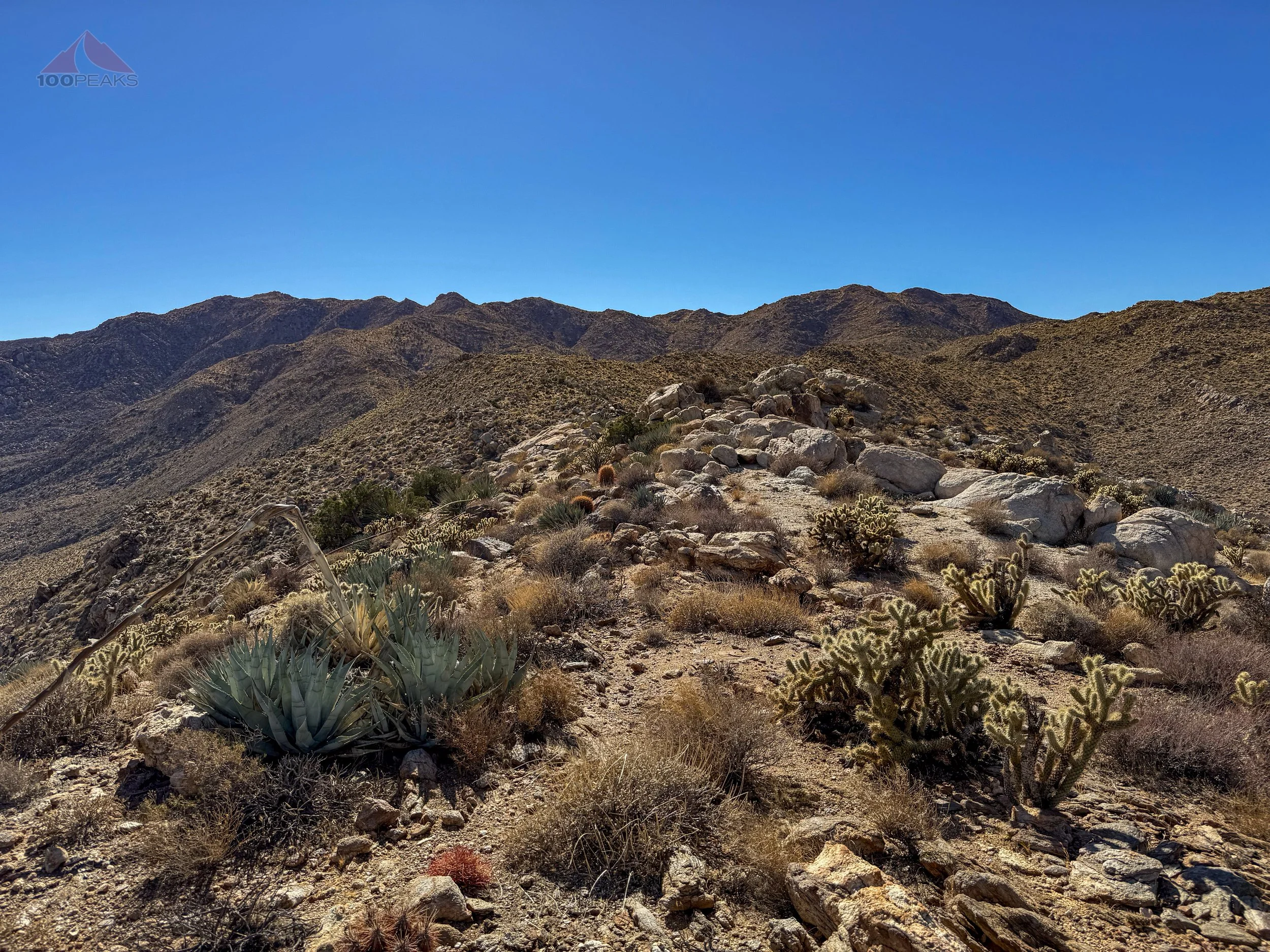
The way ahead is up the hill in the center, then along the upper ridge to the shoulder to the right of the pointed ridge top
This was the “choose your own adventure” section, reading slope, brush, rock, and effort, rather than following a line on the map. I climbed slowly, letting my heart rate settle when needed. Certain features felt familiar, including an upright white granite boulder perched between two hills: the Upright Boulder Shoulder.
Upright Boulder Shoulder
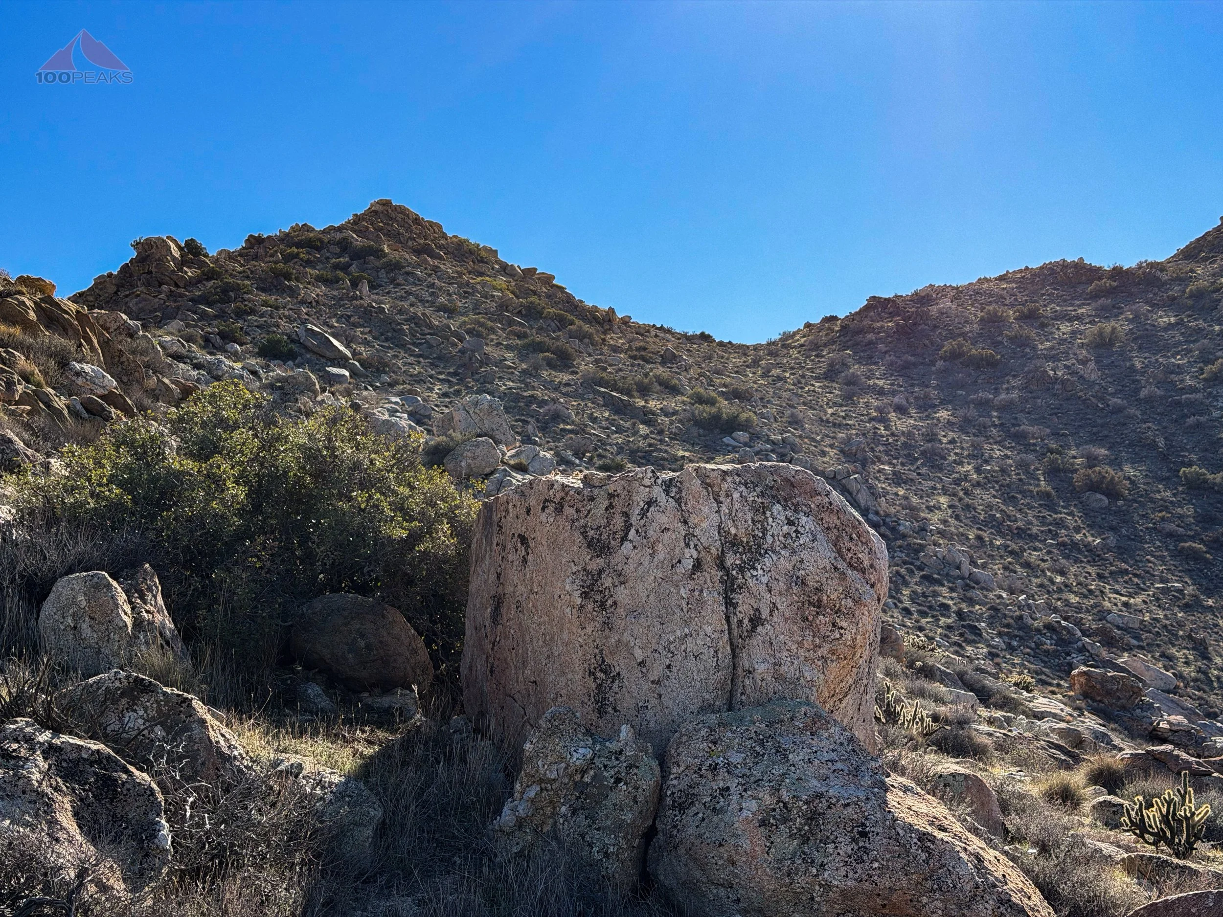
Beyond it and over a first of five knobs, I aimed toward a saddle on the right past the second knob.
Once atop the saddle, the ridge and views opened wide up. Boot prints appeared and disappeared. I lost them, then found a faint path threading through boulders and brush. It wasn’t a formal trail, more a convergence of use over time. Human, animal, old, new. The kind of line that only reveals itself if you stop trying to force one.
I passed occasional large pile of coyote scat.


Once on the shoulder, recent rains made things clearer. A gentle, rolling traverse cut across the hillside, sometimes grass, sometimes gravel, obvious if you didn’t look too hard. My pace quickened. I counted rocky bumps as I passed beneath them. Three, four, five.
Jacumba’s summit finally came into view.
My first real look at Jacumba Mountain
A grassy ramp led to what I hoped was the top, but turned out to be a false summit. The real one followed shortly after. I stepped onto the flat summit of Jacumba Mountain and stood quietly for a while.


The view to the south from Jacumba Mountain
Panoramic view from the top of Jacumba Mountain
The views stretched from Mexico to Toro Peak, some sixty miles north. I signed the register, drank some water, and rested.
I sat on the summit boulder, signed the register, and relaxed into the idea that I finally made progress on my 100 Peaks list. Many people have completed it before me. But I’ve had plenty of my own adventures along the way.
We opened our second Burger Bench location in Vista this year. As you can imagine, the twists and turns of doing something again that we did 10 years ago took a lot of my time and energy. I also focused on overnight trips with my daughter and friends. We traveled with family.
My relationship with the outdoors have changed since I started this part of the journey in 2009. It has become less of checking-of-the-boxes and more of an exploration. I enjoy slowly moving through the areas and absorbing the place, rather than any attempt to “conquer” or speed through out.
I looked at the setting sun and it was time to start down.
The descent was long but efficient. I found the line again, enjoyed the afternoon light on the ridge, and moved steadily through familiar landmarks. My legs shook near the end, but trekking poles saved the day. Darkness settled in as I reached the car.


I changed clothes, started the engine, and drove slowly out the rocky dirt road, satisfied with a wonderful day in the desert
Dos Cabezas Water Tower at night
Completing Jacumba Mountain felt good, but not in the way it might have years ago. Somewhere along the way, the summit stopped being the only point. What matters more now is how I move through these places: slowing down, paying attention, noticing patterns, and letting the landscape set the pace instead of my watch.
When I started the San Diego 100 Peaks Challenge, I was focused on summits, numbers, and progress. Somewhere along the way, I began to appreciate different things: a well-chosen route, an unexpected view, a quiet canyon, or simply spending time in a place without feeling the need to rush through it.
The desert is the same as it has always been. I'm the one who changed. And in many ways, that's what this challenge has given me.
Jacumba Mountain Trail Map - Overview (Click to enlarge)
Jacumba Mountain Trail Map - Section 1 - On The Trail (Click to Enlarge)
Jacumba Mountain Trail Map - Section 2 - Off The Trail (Click to Enlarge)

