Guatay Mountain Hike (Peak 48) | San Diego 100 Peaks Challenge
Guatay Mountain is my Peak 48 of the San Diego 100 Peaks Challenge, a scenic summit in the Cleveland National Forest near Pine Valley. The trail climbs through chaparral, oak woodland, and sections of rare Tecate Cypress before reaching a ridgeline with expansive views of San Diego's backcountry. This guide includes trip details, photos, and a trail map for hikers interested in exploring one of the lesser-known peaks in eastern San Diego County.
Guatay Mountain
Elevation: 4,889′
Mileage: 5.2
Trailhead: Pine Creek Trailhead (Adventure Pass required)
Agency: Cleveland National Forest
Date Hiked: 10/17/2010
Peakbagger.com Page
For those interested, here is a list of my gear that I have found works well for me. This is, of course, an affiliate link and your enjoyment of these may vary:
10/17/2010
Local lore has it that there is a Kumeyaay chief buried on Guatay Mountain who has visited town residents over the years. The chief is also cited as the reason that the mountain hasn't burned in recorded history.
Not deterred by the possible existence of ghosts on the mountain, the PD and I left early, driving through foggy mist. San Diego had been drizzled on for over 24 hours and I was worried the trail to the top of Guatay would be soggy and slippery. I was pleasantly surprised when the fog lifted within the space of a few seconds just outside of Pine Valley.

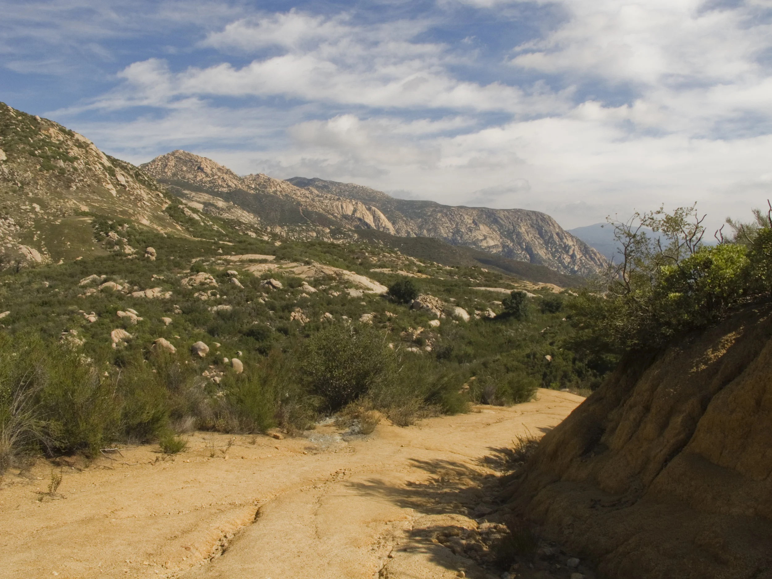
Sunrise from the Guatay Mountain Trail from the trailhead near Pine Valley California
We made it to the trailhead in great time, but it was a little chilly at 43 F. After a false start when I realized that I had forgotten to put my Adventure Pass on my windshield, we geared up and started hiking our way up the trail, and, as we rounded a corner, we felt the sun shining on us. Within 5 minutes, we were stripping down to our base layers as the day and ourselves warmed up.
As we climbed and climbed, I was reminded of several trails from my previous peaks. Black Mountain and Viejas Mountain came to mind, with their orange soil and rocky inclines. After a steep ascent, we made it to the ridge line. From there, we could see the drizzling marine layer, blanketing most of San Diego to the west. A few peaks were peeking up through the white clouds, namely Corte Madera and Los Pinos Mountain.

Corte Madera and Los Pinos Mountain in the distance
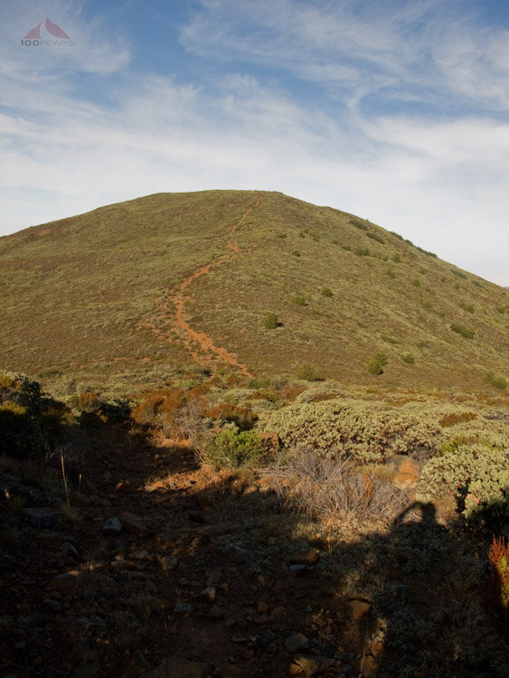
Ridgeline section of the Guatay Mountain hiking trail

The trail through the grass
We also had a glimpse of the rare Tecate Cypress that grow on the northern flanks of the mountain. I didn't feel like bushwhacking this morning, which is why I chose Guatay Mountain in the first place, so we didn't visit the trees up close.
The ridge undulated ahead of us, each high point a promise of the peak. After several steep inclines, we made it to the top. There was a circle of stones of unknown origin, a waterproof summit register, and off to one side, a reference benchmark. We sat down, enjoyed the sun on our backs, and breathed in the fresh morning air.

Guatay Mountain ring of stones

Summit views from Guatay Mountain looking across southern San Diego County.

Guatay Mountain reference benchmark

Cuyamaca Peak, Stonewall Peak (Cush-Pi) and Oakzanita Peak from Guatay Mountain
The rest of the San Diego to the west was experiencing a grey, drizzling morning, and here we were, dry and sunny at the top of a mountain. Kept company by the occasional barking dog, crowing rooster, and the constant hiss from the Interstate 8 Freeway, we ate our snacks, sitting on the summit stones, and began the knee and toe-busting trek downward.
On the way down, we spotted a small horned lizard running for cover. Another lizard of a different color.
It never gets old. Every peak has its own personality. Sure, some may have similar views and similar trails, but every mountain I've been on has presented a new challenge and a new reward.
I don't intend on stopping any time soon.
Guatay Mountain Trail Map (Click to enlarge)