


Peak 67B - Oriflamme Mountain - A quick overnight trip to share with the stars
Chariot Mountain
Elevation: 4,803’
Mileage: ~4.5
Trailhead: Lucky 5 Ranch Trailhead
Agency: Bureau of Land Management
Date Hiked: 06/20/2020
Peakbagger.com Page
For those interested, here is a list of my gear that I have found works well for me. This is, of course, an affiliate link and your enjoyment of these may vary:
06/20/2020
As the craziness of the pandemic continues, it’s really nice to get away to some peace and quiet and spend some time for oneself.
On that note, since Square Top has been removed from the list due to some access issues, I decided to add Oriflamme Mountain to the list to replace Square Top.
While fairly similar to Chariot Mountain, in that it is an inverted hike along the edge of the Anza-Borrego on a dirt road with a cross-country trek to the top, I felt it was different enough and a little further south. It allows hikers to get a sense of the beauty of upper Oriflamme Canyon, as well.
With a full backpack for a short overnight trip, I headed out on a Saturday afternoon, arriving at the trailhead near 5pm in the afternoon. I knew the trail was mostly downhill and only about 2.25 miles, so I wanted to miss the heat of the day, but still give me enough daylight to find a decent dispersed campsite.
The idea was to lose and immerse myself in the San Diego backcountry.
I parked at the Lucky 5 Ranch trailhead, making sure not to block any gates. There was one other car there, but they appeared to have been wrapping up their day hike. They were gone by the time I got out of my car. I knew I would have the mountain to myself this evening. Excellent.
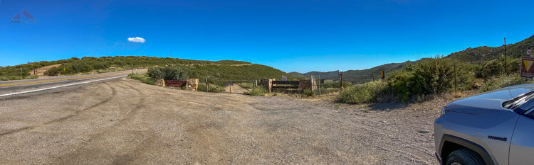
Oriflamme Mountain Trailhead
I crossed the Sunrise Highway to the trail, which is an unnamed dirt road leading all the way down to the desert floor. I had studied the maps carefully, since there is a network of dirt roads leading in a variety of different directions. I would have to be careful at the forks in the road, but this was nothing new.

The trail rising away from Sunrise Highway
I ascended the small hump leading up from the highway and got a nice view of Oriflamme Mountain. The trail dropped toward a seasonal creek bed, which is now dry, but I have seen great pictures of springtime flowing. In my head, I named it Oriflamme Creek West Fork.

Oriflamme Mountain comes into view with Whale Peak behind
Something scurried by my feet and a large horned lizard ran into the shade on the other side of the trail. This is prime habitat for them.

Colorful Horned Lizard
Rising up out of the creek bed, I crossed the Pacific Crest Trail, noticing how it nearly parallels this portion of the trail to Oriflamme Mountain, but diverges as I continued down to the bottom of Oriflamme Canyon.

Crossing the PCT, notice the fly in the photo
From the top of this rise, I could see the various mountains around me. Surrounded by thousands of silent moths, I scanned for potential campsites below, but nothing ever looks the same on the ground as it does on Google Earth.

View from Granite and Chariot Mountains from the trail to Oriflamme Mountain
I continued downward, enjoying the breeze as the day slowly cooled. Whenever the breeze died, I would be surrounded by flies, gnats, and mosquitoes. I was tempted to get out my bug net, at the ready in my hip belt pocket, but the breeze would return and offer me some relief.
I passed by an overturned car, driven off the road many years ago. I didn’t inspect it, but, since everything had been stripped off of it, it was hard to tell what make or model it was.

Overturned car on the way to Oriflamme Mountain
I reached the sandy bottom of upper Oriflamme Canyon. There was evidence of off-road vehicles and seasonal water flowing. I was constantly on the lookout for campsites, but started feeling that camping on the peak of Oriflamme Mountain might be a great idea, especially if the breeze might keep the bugs away, and an early sunrise would warm me up for an early hike out.
I came upon three major forks in the road and took them left, right, and then left. Two of them felt pretty counter-intuitive, but I was sure to check my map as I went.

Turn right here, at the second fork

Turn left here, at the third fork
The trail marched upward to the shoulder of Oriflamme Mountain and I noticed some small flat areas off trail that might work for a campsite later, but I was holding out for the peak. I had originally planned to drop my full pack and just take some water to the peak, but I ended up leaving the trail at the high point of the trail near the peak and bushwhacked to the summit.
On the way up through the mostly sparse chaparral, I scanned around the western edge of the Oriflamme Mountain and didn’t see any sites that were optimal for setting up a tent.
Once I got to the top, I could see some spots here and there, but the wind was blowing too strong. It was great that there were no bugs, but the areas sheltered by the summit rock piles did not look be large enough for my one person tent.
If I was going to camp under the stars, I may have been able to squeeze just my sleeping bag, but with all the bugs around, I was planning on some tent protection.
Setting down my full backpack, I texted my wife and enjoyed the views. I was going to be going back down to the trail and look for a site.
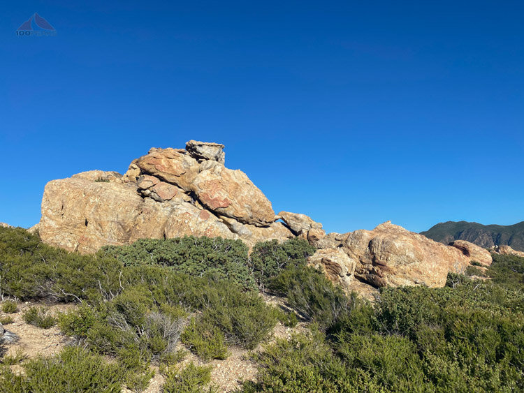
Rock formation near the top

Looking south from Oriflamme Mountain toward Garnet Peak and Garnet Mountain

Panoramic view from the top of Oriflamme Mountain looking North toward Granite Mountain and Whale Peak
With the wind and the views into the desert around me, I didn’t want to leave, but I knew this peak would be one of the last places in the sun and the areas below would be in darkness soon. I got by backpack back on and headed down to the shoulder area.
After wading through some brush, I found a great little spot a few hundred feet off the road. The ants were fairly sparse and I could see no sign of human use.
I pitched my tent and set up my camp chair. The bugs were out in force and I put my bug net on, which helped a great deal. It really was a symphony of buzzing, and I saw flies, big and small, gnats, bees, beetles, butterflies, moths, and mosquitoes.

My campsite for the evening, near Oriflamme Mountain
Just as i was wondering if I was going to be able to sit outside and enjoy the evening, the sun dipped below the mountains to the west and a slight cool breeze picked up and the bugs completely vanished. I took off my head net and was able to fully enjoy the coming dusk.
I sent a map pin drop to my wife, to let her know where I was, and made some nice hot dinner as the evening cooled and darkened. Only upon returning home did I realize that my pin drop placed me miles to the northeast, which would have really confounded a search based on that information.
I settled into my camp chair with some cold beer from an insulated growler and stared at the stars that emerged one by one from the twilight. For about 2 hours, I relaxed into the wilderness and sky with no sound except the slight breeze through the brush.
Granite Mountain loomed large in the distance and I recognized the unmistakable shape of Whale Peak, and could pick out the peaks along the Mount Laguna Ridge of Garnet Peak and Garnet Mountain.
A wave of calm flowed through me. I am sure the beer was nice, but it really was being alone in a beautiful place, with no one except the wildlife around me. There was no urgency; the camp was made, dinner was eaten, and I had no hiking to do until tomorrow.
I was free to be in the moment and drank it up as much as I could.
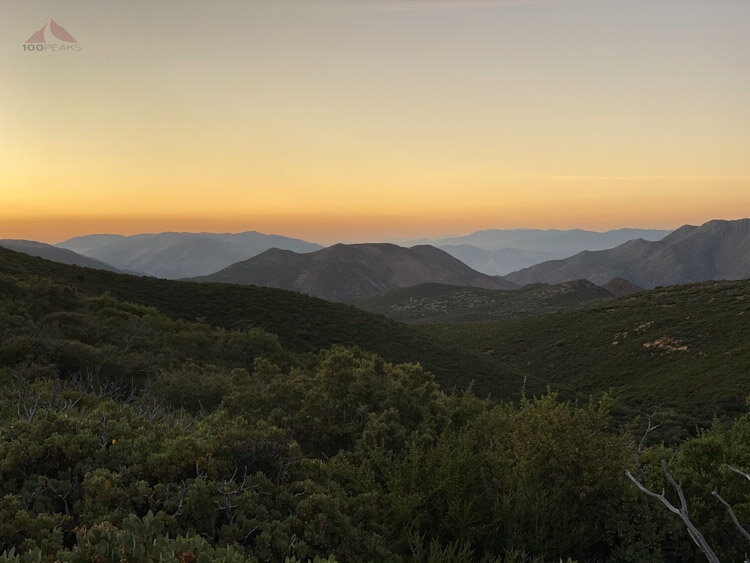
Dusk across the chaparral
At around 10pm, after seeing countless satellites arc across the star-filled sky, I retired to my tent to discover the site was a little too slanted toward my feet than was ideal. Regardless, I slept very well in the silence.
I woke up at about 6AM the next morning to some singing birds and had a nice breakfast as the sun warmed the bushes around me. I had some breakfast and coffee, enjoying the active bird song.
The bugs woke up, too, so I packed up the campsite and headed out.

The way back up the next morning
Already very warm, I made my way up the road through the moths and bugs, wearing my head net until I made it to the final hump before the car, when the breeze returned, cooling me off and blowing the winged devils away.

Morning along the trail
I picked up some garbage along the trail on the way out that I had noticed on the way in and crossed the highway back to the car. I looked at the time. It was just past 8AM. I had been in the wilderness barely 15 hours and returned to civilization energized and ready for whatever would come next.
Oriflamme Mountain Trail Map (Click to enlarge)
I’ll have to do this more often.

