


Peak 78 - Chariot Mountain - An inverted hike along the edge
Chariot Mountain
Elevation: 4,680’
Mileage: ~9.3
Trailhead: Mason Valley Truck Trailhead
Agency: Anza-Borrego Desert State Park
Date Hiked: 06/04/2020
Peakbagger.com Page
For those interested, here is a list of my gear that I have found works well for me. This is, of course, an affiliate link and your enjoyment of these may vary:
06/04/2020
On a recent family hike, we enjoyed some grasslands along the eastern edge of Cuyamaca. Chariot Mountain was on my list, so I was able to see it as I hiked along the trail.
A few days later, after some research, I set out to get to the top.
I had a relaxed drive through Ramona, Santa Ysabel, and Julian and arrived at the trailhead. Parking along the road without blocking the gate, I did my usual sunscreen ritual and headed out on the trail, excited to be exploring yet another new area in the county. The temperature was to be in the 80’s.

Looking back at Highway 79 through the Mason Valley Truck Trail gate
Mason Valley Truck Trail is a nice rolling road through the trees. The bugs were out and I wished I had brought my head net. As long as I kept moving, however, they weren’t too bad.
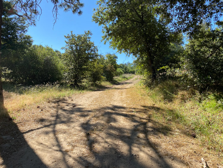
Heading up on Mason Valley Truck Trail
Before long, on my right was a pretty little area with a large pond. It was reminiscent of the area around Lake Cuyamaca, but on a smaller scale. I envisioned coming back to explore during a season with fewer bugs.
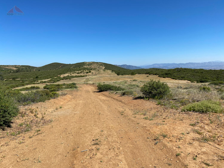
I continued up the road until it opened up to a high mesa, surrounded by grasslands and many crows.
Looking back along the ridge above Chariot Canyon
I removed a layer and had a nice snack. The breeze was nice and kept the bugs away for the most part. I decided to quickly scramble to the top of Julian Ridge Benchmark, which is just few hundred feet off the trail.

Nice view from Julian Ridge Benchmark

Heading down along the ridge toward the PCT
I crossed the PCT at the same point I did on my hike a few days back and started the way down into Chariot Canyon, passing a water source and what looked like a PCT campsite.
It’s always nice to be on this side of the mountains, perched on the edge of the desert, one foot in the trees and the other among the cactus.
I got my first views of the path ahead, looking across to Granite Mountain and my destination, Chariot Mountain.

First views of Granite Mountain and Chariot Mountain
I continued the downward path on the dirt road, enjoying the quiet of the morning. I wondered how fun it would be to hike back up this afternoon. From time to time, the bugs would be overwhelming, but then a breeze would blow them away.
My path ahead opened up below me. I could see where I would turn right on the road and the left up the old fire cut up to the summit of Chariot Mountain.

Chariot Mountain with Whale Peak in the distance

View of the rest of the route to Chariot Mountain from Mason Valley Truck Trail
I got to the sandy valley floor and saw the first signs of snakes crossing the trails, but I saw nor heard any snakes that day. The breeze became more consistent and the bugs stopped bothering me for a mile or so.
I made the right turn where the Mason Valley Truck Trail intersects with the California Riding and Hiking Trail and searched along the left side of the trail for a pile of branches where the fire cut would begin.
The bugs came back as the day heated up. I made my way up the steep overgrown cut, following in the occasional footsteps of the last peakbagger that was there.

Following the cut in the brush to Chariot Mountain above
Mindful of snakes, cactus, and foxtails, I made my way up the steep hillside. I was able to have a signal, so was able to communicate with work a few times, who had no idea where I was.
After going over the first false summit, I made it to the high point. The breeze was not as active as the valley below, so the bugs came out to play. There were all sorts of shapes and sizes, from tiny gnats to large beetles coming out to say hello.

The view back toward the Lagunas, the path up Mason Valley Truck Trail up the middle and up to the right

The view from Chariot Mountain
After soaking up the views from my perch on a rock, I had a quick snack and headed back down.
Instead of going up and over the other summit, I headed along the side of the hill until I met up with the cut, where I could see it go all the way down to the road. There was a rock formation that I called the Gunsight in my head, through which I made my way.

The Gunsight and the cut leading all the way back down to the road
The day heated up hotter than I expected, but I had plenty of water and when I was getting attacked by bugs, the breeze picked up and never relented on the entire way back, clearing the way of bugs and cooling me off.
There are other ways to get to this peak from various trailheads, but I liked this one, although from the Fages Monument would be a nice alternative.
I didn’t see a single other person on the trail the entire time.
Chariot Mountain Trail Map (Click to enlarge)

