Thorn Point - Peak #22 - Sharing the trail with bear tracks
Thorn Point
Elevation: 6,920′
Total Mileage: ~7.5
Trailhead: Thorn Meadows Campground
Agency: Los Padres National Forest
Date Hiked: 08/25/2013
Peakbagger.com Page
For those interested, here is a list of my gear that I have found works well for me. This is, of course, an affiliate link and your enjoyment of these may vary:
08/25/2013
It had been a busy week. Actually, it had been a busy month. We finally had a free weekend. Saturday was a nice, relaxing family day that involved swimming, shopping, and dining out. Earlier in the week, I had scoured our family calendar and blocked off Sunday for a hike.
I turned to my wife and said, "I'd like to go hiking tomorrow."
She replied, "It's on the calendar, you have to do it."
It's nice to know that she understands that my sanity depends on getting some alone time in the outside.
I got out my laptop and scoured the area to see where I'd like to hike. Once again, I was confronted with how far the trailheads are from my home. But, as I've told my daughter, if you want to find adventure, you have to go out and get it.
I opted to go back near Lockwood Valley and go to Thorn Point and San Guillermo Mountain.
I woke up at 5:30AM. I knew it was going to be warm 2 hours north from the coast. I've recently moved and it's going to end up shaving on average 30 minutes off my round trip trailhead driving time. I cruised through Ojai, making sure I refueled, as I didn't want to get stuck out there with an empty tank.
I had been in this area before, driving on the same dirt road when I had hiked to Lockwood Peak. Once again, I felt like I had the road to myself as I drove south until the road ended. I turned off the engine and got out of my car.
After 2 hours of asphalt and dirt road noise, I was keenly aware of the sudden silence all around me. It felt great.
Mine was the only car at the Thorn Point trailhead, which is a campground with two picnic benches and a restroom.
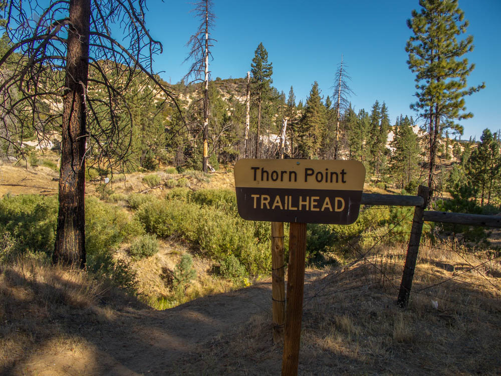
Thorn Point Trailhead Sign
Some gun-happy people sure had their fun with the restrooms.
I did my usual trailhead prep:
Switch from sandals to socks and trail runners, Vasque Mindbenders. (I recently wore out my last pair of Vasque Blurs. I had purchased four pair back in 2009, since they fit so well. The Blurs are not made any more. The Mindbenders have the same lower components and fit perfectly out of the box.)
Put on sunscreen
Change shirts (I like to drive with cotton, but hike with wool or synthetics)
Change sunglasses
Record my trailhead video
Double check my paper map, food, water, cameras
Ready my trekking poles and hat
Start my phone GPS tracking app
I was about 10 seconds on the trail when I looked down and could clearly see black bear tracks in the soft sand. The tracks were of one bear walking in the opposite direction, so that lessened the possibly of my surprising a mother with a cub or two.
I turned around to see where the tracks went. They went up to the campsite, passed the restrooms, and up and over the hill beyond. I went back to the trail and continued to hike, fascinated at how easily recognizable these prints were. There were other human shoe prints, but the bear was the latest creature to walk the trail.

Sespe Wilderness sign
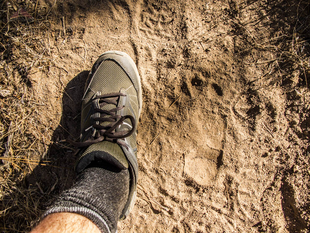
Black bear tracks on the Thorn Point Trail
I was on high alert, clacking my trekking poles together and occasionally singing and calling out the usual, "Hey, bear!" Every squirrel or lizard cause me to scan the area, especially in thick brush with little visibility.
After about a mile or so, the bear tracks left the trail to stay near the canyon floor. The trail began steeply switching back up the mountain. The bear tracks were immediately replaced by large deer tracks, who appeared to be running up the trail. I wouldn't see bear tracks any higher on the mountain.
The morning was beautiful. Near the coast, the mornings lately had been beset by a marine layer, with the sun only showing itself for a few hours every day.
Here, there wasn't a cloud in the sky. There was a lot of shade on the trail and the slight breeze was invigorating.

Fern undergrowth along the Thorn Point Trail
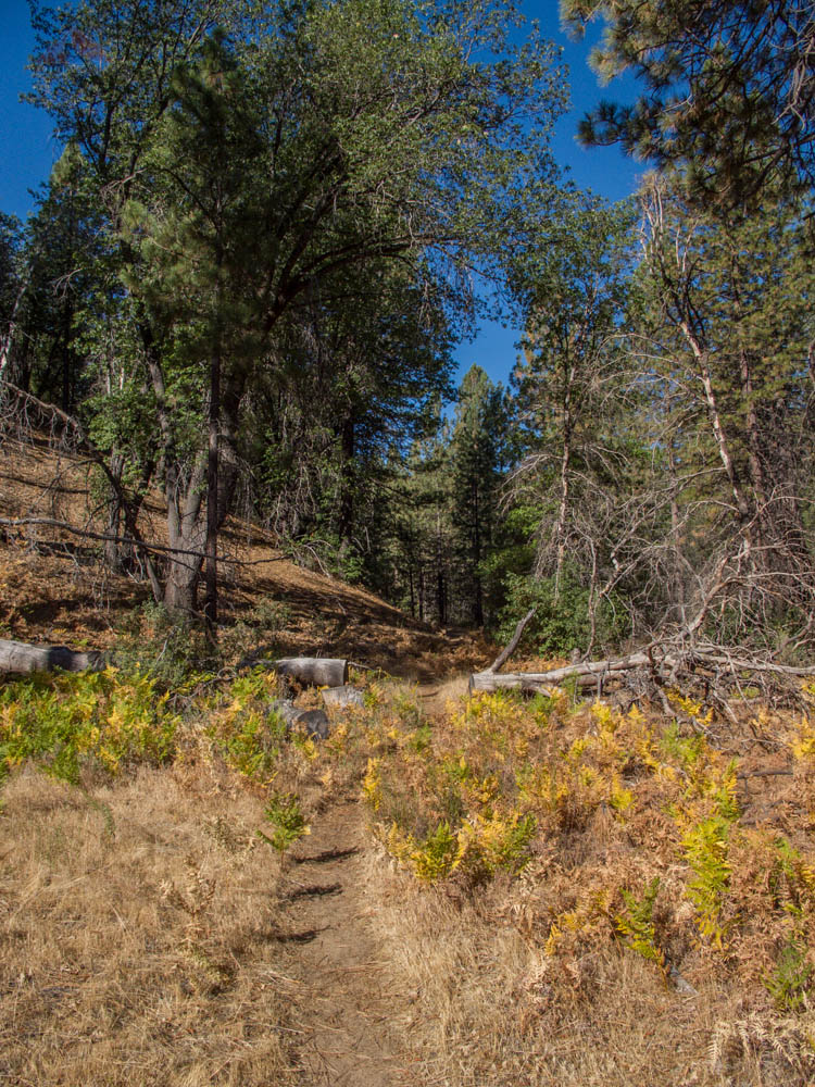
Entering the pines along the Thorn Point Trail

In the shade along the Thorn Point Trail

Ponderosa Pines along the Thorn Point Trail
In the next 2.5 miles, I would gain over 2,500' of elevation. Starting at around 5,000 at Thorn Meadow Campground, this is the edge of where I really tend to start feeling a little shortness of breath. I got a good rhythm and kept on hiking up.
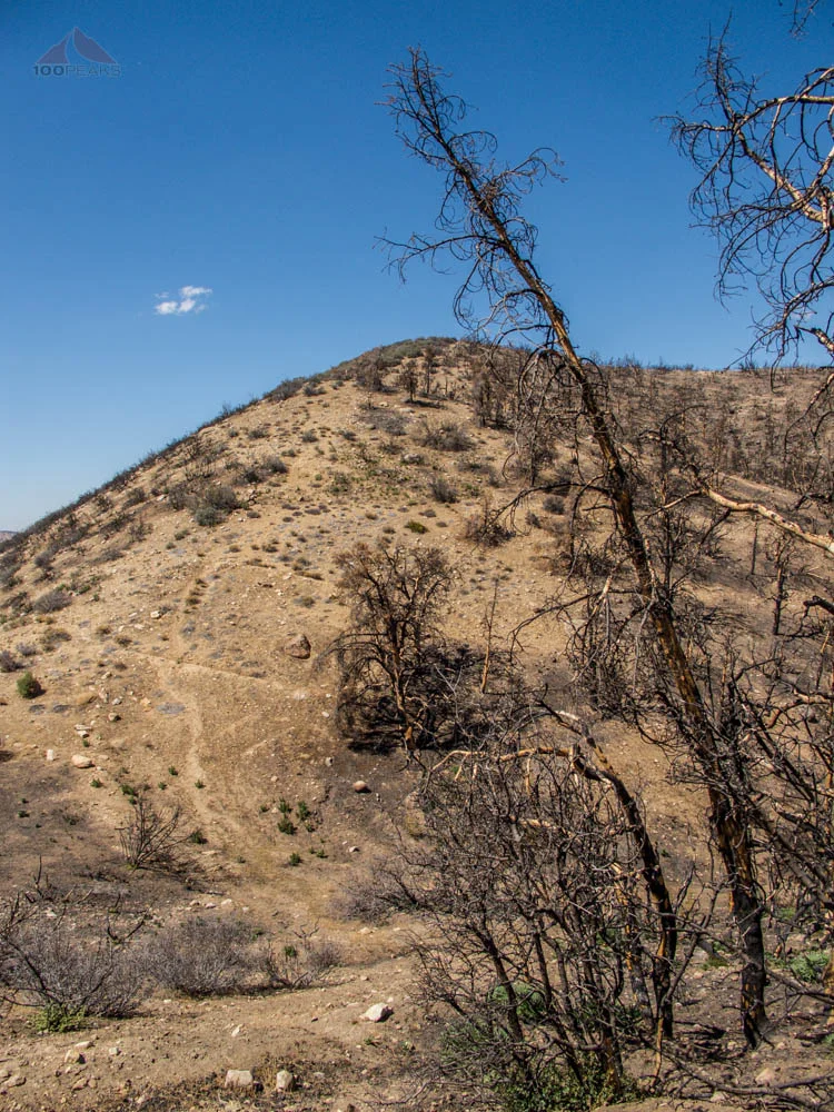
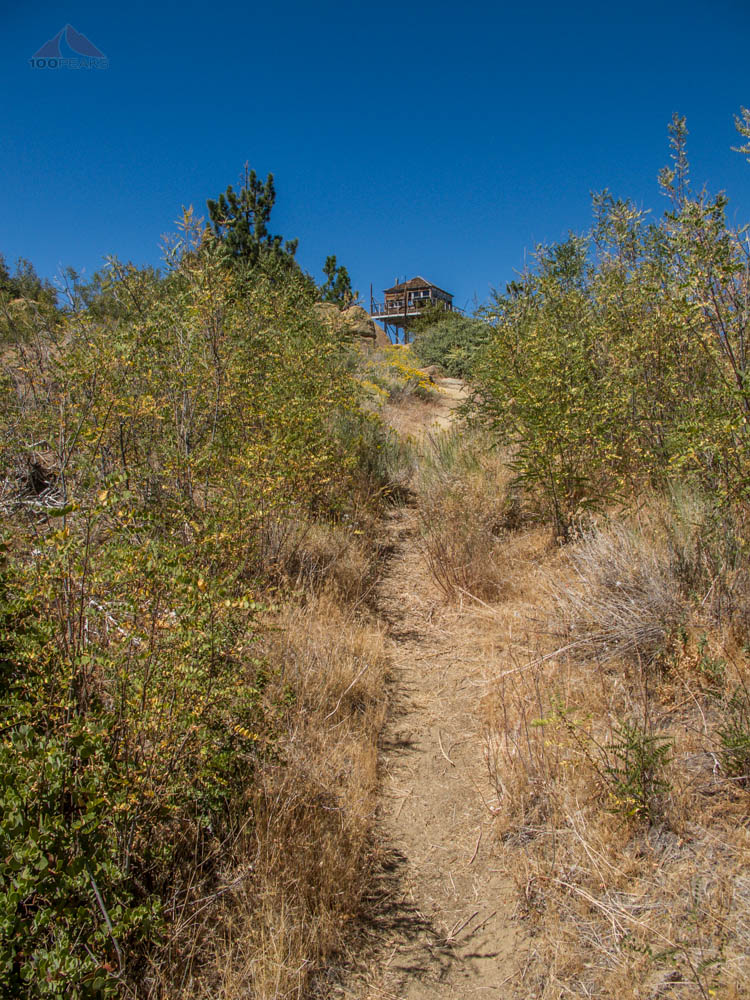
The view to the north continued to improve the closer I got. I would turn south and squint at the ridge top. The Thorn Point Lookout Tower had to be up there somewhere, but I wasn't sure which bump was the highest.

The Thorn Point Lookout Tower is at the top of that mountain
I was ascending around a tight switchback when I came across a dead yellow bird in the trail. I looked up and around and couldn't figure out what ended this bird's days. If it was an animal, I would have thought it would have been consumed. Could it have been old age? Does that happen in the wild?
I stopped for a few moments, sent some positive energy outward and continued upward.
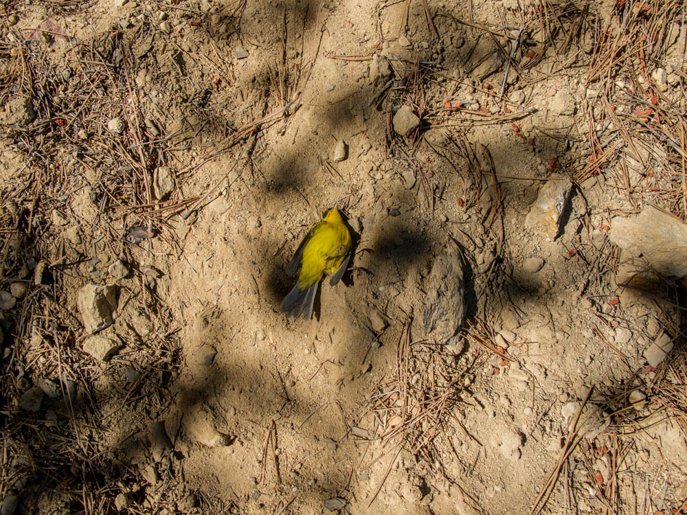
A moment of silence for the fallen
Just about .8 miles from the top, I entered a level area which was a temporary respite from the constant steepness of the trail. I looked around and could see plenty of places to pitch a tent for the night. One would likely have this area to oneself.

The steep final climb

A flat part of the trail

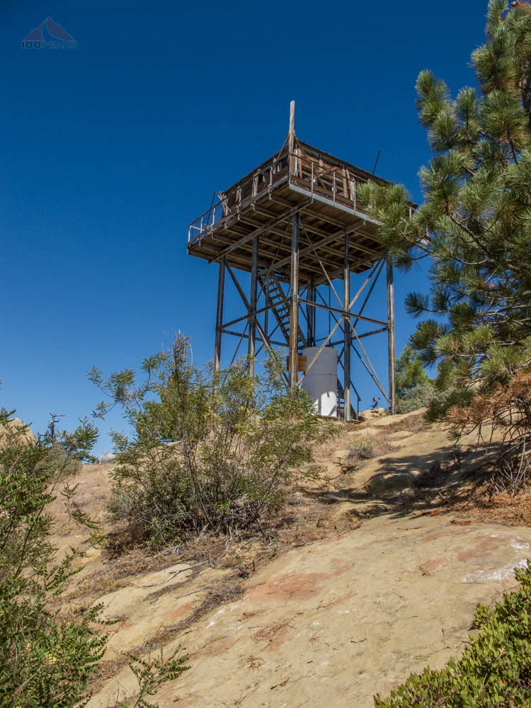
Thorn Point Lookout Tower

Flat area just before the final climb to Thorn Point
Mentally preparing myself for the final push to the top, I scrambled upward and soon could see the lookout tower. I toured the area, noticing an overturned trash can and a lot of litter all over, but no sign of bears at all.
I climbed the tower and investigated (see video below). The view was pretty amazing. I could see that the coast was still under a marine later, nearly 7,000' below me.
The steep final climb
Thorn Point Lookout Tower is in sight

Thorn Point Lookout Tower sign
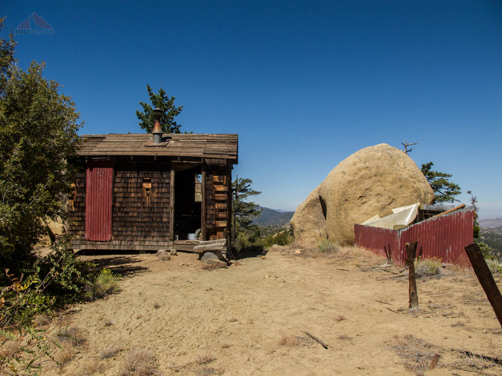
Outbuilding

Thorn Point Lookout Tower interior

Chief and Nordhoff Peaks from Thorn Point
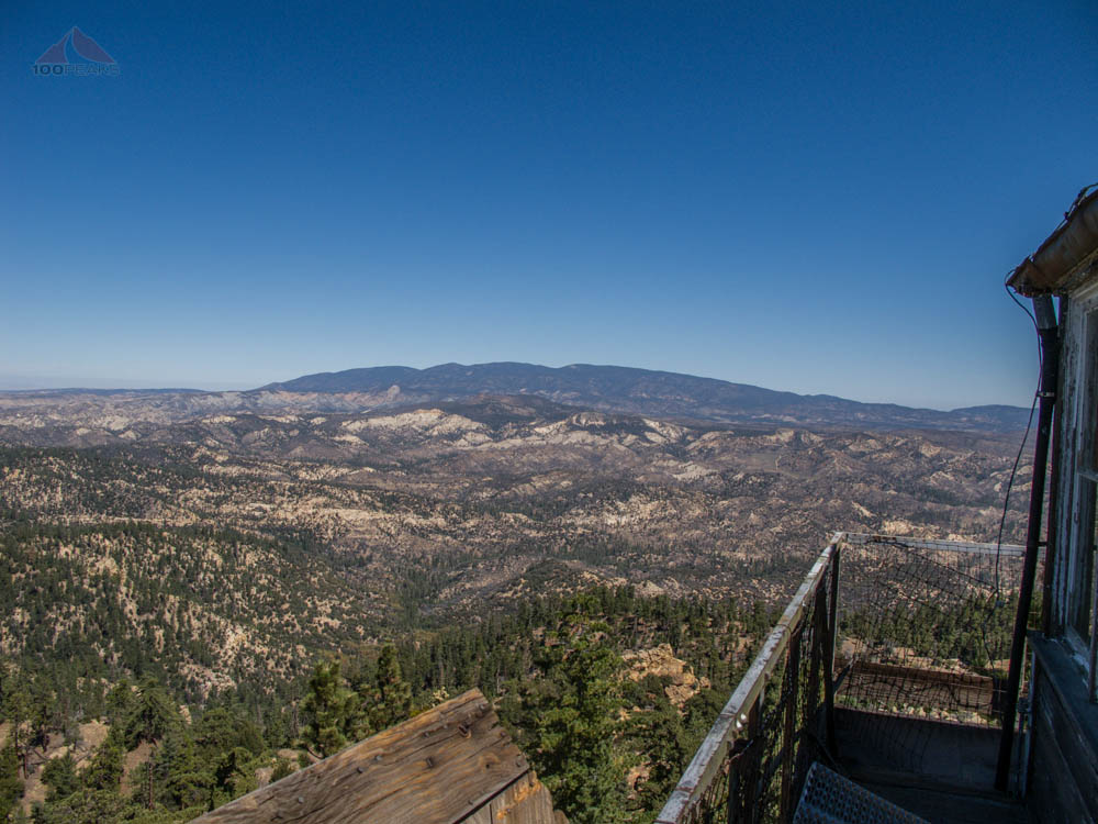
Mount Pinos and beyond from Thorn Point

Haddock Mountain from Thorn Point

Alamo and Cobblestone Mountains from Thorn Point
The weather was warm, but that gorgeous breeze kept me smiling.
I was able to get a cell signal, way out here and sent a video to my family. I decided to descend before I stopped for an extended snack. I had another peak to possibly do today.
I looked in the summit register and noticed that the human prints I saw was a party of three that went up 3 days ago. That meant that the bear had walked the trail below within the last 3 days. Likely two. Interesting indeed.
I descended the nearly 4 miles without a break, singing and yelling, "Hey bear!"
Checking the clock, I drove onto my next hike, San Guillermo Mountain, recrossing Piru Creek along the way.

Piru Creek crossing on the way out

Thorn Point Trail Map (Click to enlarge)