


Wonderland Trail Backpacking Trip – Beauty and Friendship (2019)
The Wonderland Trail is one of the premier backpacking routes in the United States, circling Mount Rainier through alpine meadows, glacier-fed rivers, and dramatic mountain scenery in Washington’s Mount Rainier National Park. This trip includes trail maps and reflects on a memorable multi-day journey shaped not only by the beauty of the Pacific Northwest landscape, but also by the friendships and shared experiences formed along the trail.
Wonderland Trail
Dates Hiked: 08/5/2019-08/17/2019
Agency: Mount Rainier National Park
For those interested, here is a list of my gear that I have found works well for me. This is, of course, an affiliate link and your enjoyment of these may vary:
Our Wonderland Trail Map with our route and itinerary
Note: If you have any questions regarding logistics of backpacking the Wonderland Trail, please feel free to Contact me.
In a Nutshell
The Wonderland Trail is an amazing and challenging trail with many personalities and a lot to offer. It is a ~93-mile loop that crosses many glacial valleys, so the trail is mostly steep both up and down. It requires planning for resupplying and permits. There are rainforest and alpine sections, plenty of views, and some of the lushest plant life you’ll find anywhere.
The Idea
It was October 2018, I was at Jeff Hester’s Six-Pack of Peaks Challenge Finishers Party. I heard some talk of Jeff and Jason Fitzpatrick (of Mile, Mile, and a Half…) planning a trip to the Wonderland Trail. I had heard of it, and it was on my long term adventure list.
A little over a month later, I was attending the SoCal Switchback Showcase, which highlighted some of Jason’s wonderful work, and saw Jeff and Jason again. The conversation turned into the Wonderland Trail again and I asked them a few questions about it. I went home and did a little research. I was intrigued.
I hadn’t been on a camping trip for more than 3 or 4 nights in decades, but was eager to dip back into the experience.
Two weeks later, I emailed Jeff and Jason, “If you guys wouldn’t mind some company this summer, I’d love to rudely invite myself.”
They responded that I could come (Yay!) and we started the planning process. Which is really half of the fun.
The Plan
We got online and did a bunch of research. I read a book or two, bought three different maps, and the great resource Hiking the Wonderland Trail website was an essential tool in helping plan the trip, especially the itinerary planner.
One of the most amazing things I found about the trip is that each campsite has anti-bear food storage (normally a tall pole onto which you hang your food bag), a nearby water source, and some sort of pit toilet. This was promising to be some outright luxury on the trail. And I wouldn’t have to carry a bear canister.
We each submitted several itineraries to the National Park Service during the submission period from March 15 through April 1 and waited to see who, if any of us, got lucky enough to get a permit.
However, from April 29 to May 4, we all received denial emails from the National Park Service. So we mailed off our resupply buckets to Sunrise and Mowich and decided to try for a walk-in permit.
Through a mistake on my part, I scheduled a camping trip that ended the night I was to be arriving in Washington State. As a result, I had to fly out on the day we might be entering the wilderness.
One day before I left San Diego, I received a text from the Jason; they had secured a walk-in permit for 13 nights, a few more days than I anticipated, but it was going to work. There was a long day that front-loaded the trip a little bit, but there were some nice short days and 2 out of the last three nights were in group shelters. The planning side of my personality breathed a sigh of relief and quickly started mapping out the trip and calculating miles.
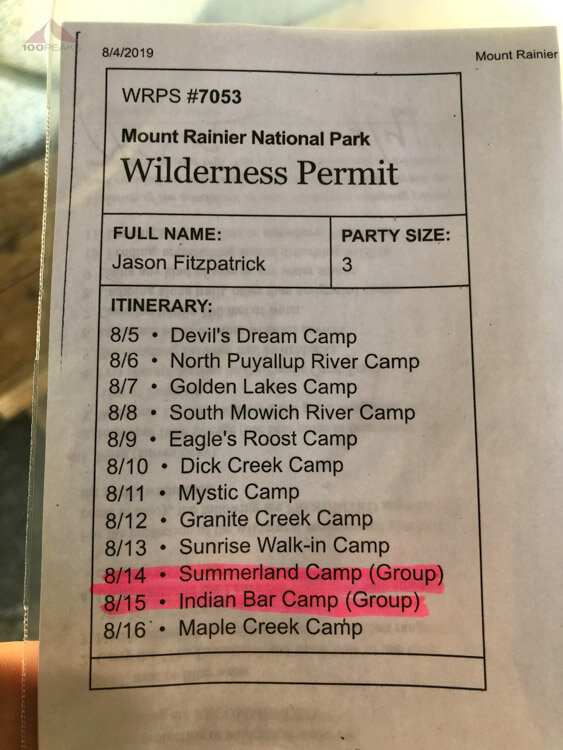
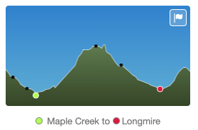
Our permit and itinerary for the Wonderland Trail
Day 1 - Longmire (Cougar Rock) to Devil’s Dream
8.7 Miles
A hot and humid introduction to the PNW
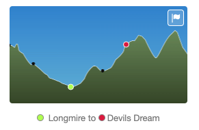
The green dot is Longmire, we parked a bit to the left

The Wonderland Trail SIgn
I landed in SEA-TAC and immediately grabbed a Lyft ride to Mount Rainier National Park. I am not sure if my driver knew what he was getting into. We chatted about the world as we left the city and made our way into the mountains.
My driver had to connect to the visitor center wifi to finish the ride. Later, I had to call Lyft to be able to leave him a sizeable tip, since my window of opportunity was lost while in the backcountry.
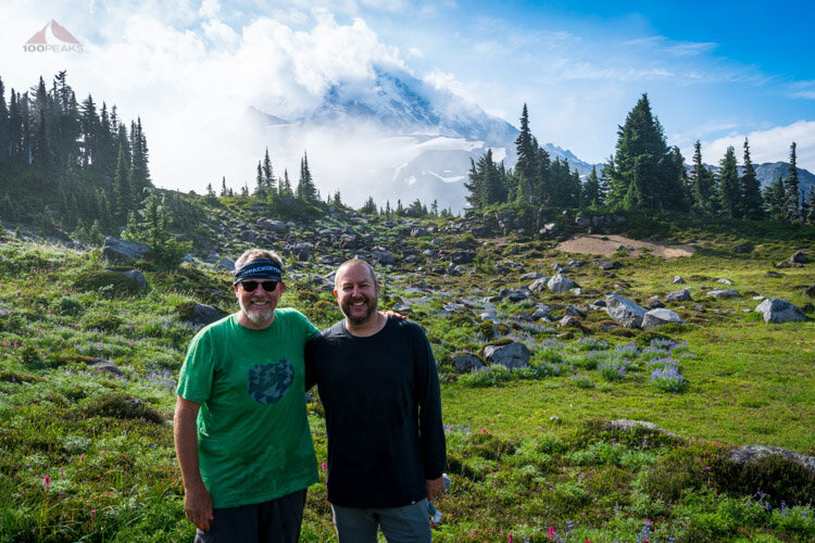
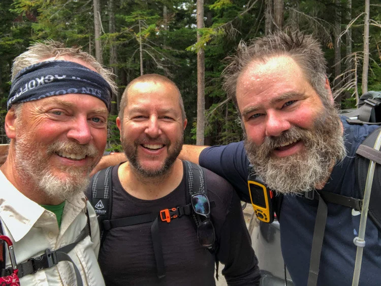
I said hello to my two friends, who were to become my traveling companions for the next two weeks.
We had a nice lunch at the Inn and drove up to a trailhead near Cougar Rock Campground. While this lengthened our first day, it reduced our final day. We’d like to get back to the car as soon as possible on our last day, for sure.
We headed out on the road that led to the trail
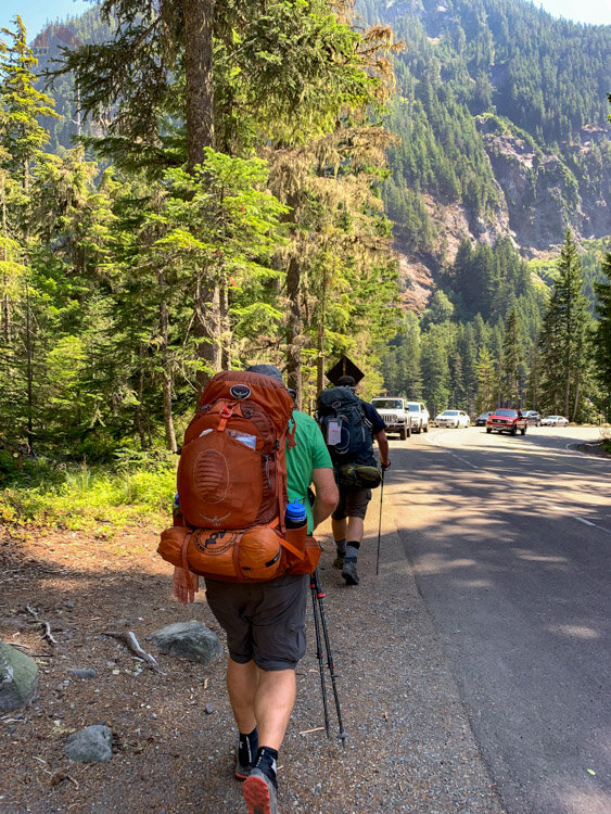
Heading off to the Wonderland Trail trailhead

All fresh at our beginning of the Wonderland Trail
I was excited. This was a chance to see how I would enjoy an extended backpacking trip after I’ve spent the last ten years improving my experience and gear on long day hikes and many shorter backpacking trips.
I had also not experienced the PNW, and was only attuned to the nuances that the Sierra Nevada could throw at me.
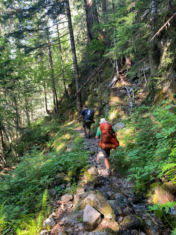
The first few miles were nearly flat and carpeted with soft crushed leaves and wood. It was shady and really nice. We spent some time chatting and getting our packs comfortable. I felt great and strong. I had been training quite a bit with long steep days. After all this planning, we were excited to actually be hiking on the Wonderland Trail.

On the trail
After being in the trees for a while, we got close to Kautz Creek and we were able to see the sky and get a great view Mount Rainier. We all paused for a second. For the next two weeks, we were going to be backpacking around that mountain and end up not far from here. It seemed like a large task, but we were all up for it.

Our first view of Mount Rainier
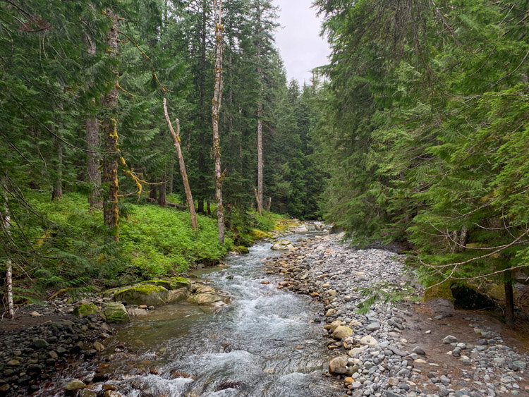
We also got a taste of our first river crossing, where we crossed a couple of logs over fast-flowing milky water and sat down for a nice rest. We also learned that these types of crossings typically meant some uphill trails to come.

Crossing Kautz Creek, a typical log bridge crossing
One we got started up the hill, it was so hot and humid, we were immediately covered in sweat.
The forest was gorgeous; more lush than I was used to. There were green plants and small creeks everywhere. The bugs weren’t bad and I was feeling good. I had a good rhythm uphill and got into the sort of hiking zone I’ve been entering in my longer trail runs.

Heading up through the trees to Devil's Dream
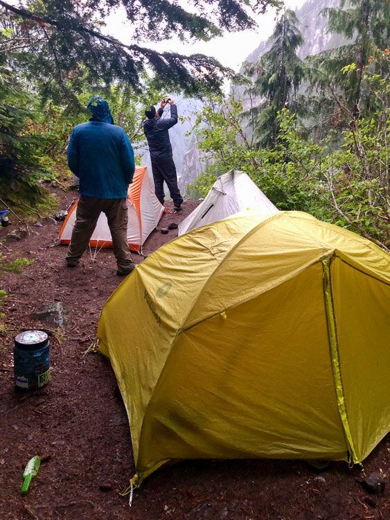
During the last mile or so, I was ready to stop. The light was getting dim as we made it to Devil’s Dream, a campsite in the woods. Jeff and I decided to hike a little ways above the campsite to get water. It wasn’t far, but I was pretty tired by then. While filling our bucket, we got swarmed with mosquitoes.

Getting water above Devil's Dream

Devil's Dream Campsite
We settled in for our first night out, each of us with our own tents, stoves, and meals. There were a few mosquitoes, but nothing too annoying. We chatted while we ate, checking out each other’s set up. Before long, we were ready for bed.
One of the last-minute decisions I made at the trailhead was to leave my lightweight camp chair in the car. I knew by doing some online research that all of these campsites had logs that would work well for sitting. I was not disappointed.

Outhouse at Devil's Dream - Luxury
The next morning, we had some breakfast and packed up to get an early start for a long day. We enjoyed a visit by a doe and two fawns before we started uphill back to Devil’s Dream Creek to fill up water.

The fawns that visited us
Day 2 - Devil’s Dream to North Puyallup River
~16.7 Miles
Paying it forward - Our longest day on the Wonderland Trail

Up, down, up, down, up, and then down
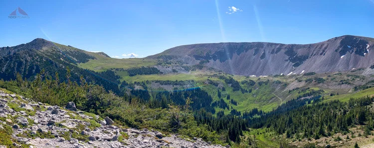
It was a short climb to Devil’s Dream Creek and then it flattened out somewhat as we hiked through Indian Henry’s Hunting Ground. It was a gorgeous morning, sunny but still cool. The flowers were everywhere and there was a nice view of Mount Rainier. We were in good spirits, but knew the day was going to be long. We had a total of three ridges to get over before we dropped the last four miles to the North Puyallup River Camp.

The cabin at Indian Henry's Hunting Ground with Mount Rainier in the background
We then dropped down into the Tahoma Creek drainage, meeting our first suspension bridge. We crossed over one at a time, swinging in the wind while the milky Tahoma Creek churned and rumbled below us.
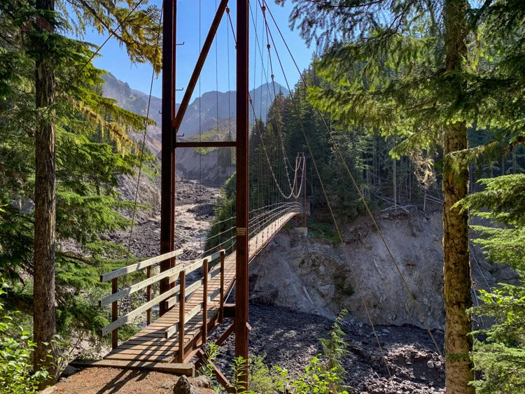
Crossing the Tahoma Creek Bridge
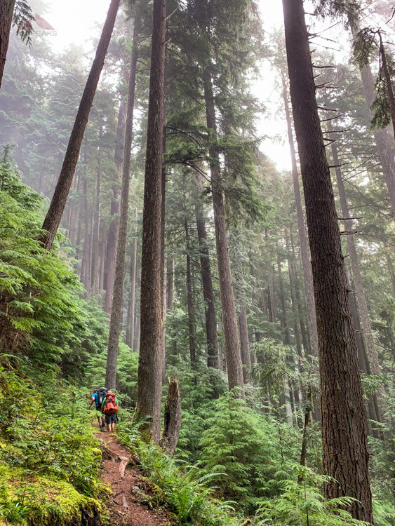
Before long, we were headed up the other side, starting the second of three climbs. This would become a sort of rhythm during our days: Hike through dense rainforest up to a ridge that potentially afforded us some views, and then down through the rainforest to a large glacial drainage and then back up again.
This, in a nutshell, is the Wonderland Trial.

Heading up Emerald Ridge, with Mount Rainier in the background
It was another warm day as we hiked the occasionally overgrown trail up to Emerald Ridge. We emerged out of the forest with a sweeping view of Mount Rainier and evidence of the periodic avalanches that run through there.
We made it to the edge of Emerald Ridge and stopped for a break before we started to head back down again. The views were amazing and we could see what we would have to climb up after our imminent descent.

Our nice rest stop at the eastern edge of Emerald Ridge, looking over South Puyallup River

Looking up at the Tahoma Glacier from our rest stop
We headed out and started hiking west along Emerald Ridge. It was pretty clear why it had this name. It is truly a special place. We started seeing more people, as there were trailheads to the west, down below, beckoning day hikers.

Emerald Ridge

Jason at the top of Emerald Ridge
Passing more and more people, we dropped down the steep trail, happy we weren’t hiking up it. After some rocky sections, we re-entered the forest, cruising along some switchbacks until we came a lovely stream. We stopped for a while for lunch and a foot soak, knowing we still had many miles to go.

Relaxing breaktime just before we descended to South Puyallup River
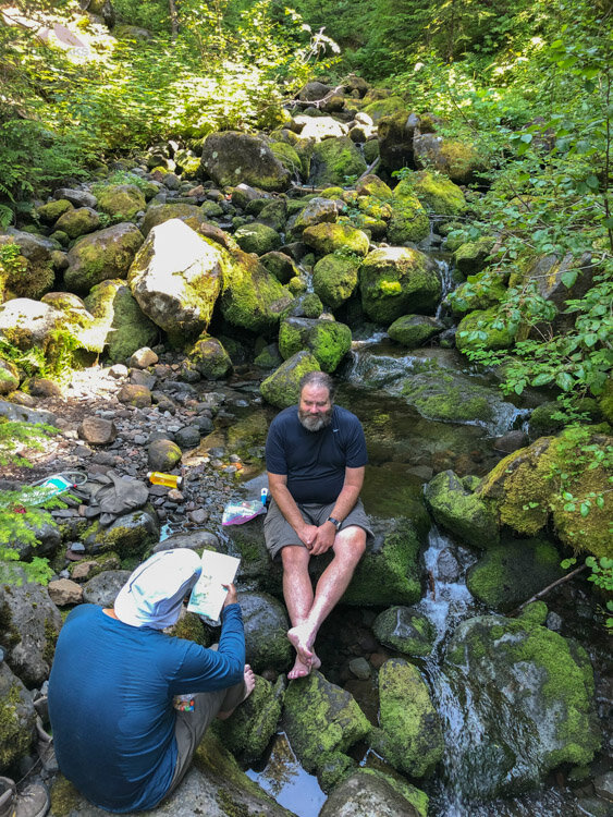
Soaking the feet and reading the map near South Pyuallup River
We crossed South Puyallup River and headed up the other side. The day warmed up and we found ourselves in another humid rainforest, brushing along vigorous leaves as we switchbacked up the steep ridge.

Heading up from South Puyallup River
After several miles, I hit a wall and started resting at the turn of almost every switchback. I drank as much as I could and counted every turn on the map. It was pretty steep and the heat was almost overwhelming as I wished for a breeze. Near the top, I could see Jeff waiting for us.

Nearing the top of the ridge, near Saint Andrews Park
We dropped our packs in some shade and had some more calories. My body was getting used to the trail. I was a little cranky, but determined to be positive. I wandered down the trail a little bit and lay down on a flat rock, enjoying the sun and remembering to focus on how lovely it was out there.
We still had some climbing to do before we would start descending.
Saint Andrew's Lake
We stopped at Saint Andrew’s Lake for another break and a water refill. It was wonderful. We wished we could camp there. One thought that propelled me forward was that there were very short days up ahead, with very little gain and loss.
Even as tired as I was, the beauty of the area was not lost on me.

A peek into the head of the North Puyallup River with Mount Rainier above
Everywhere I turned, there was a gorgeous vista down a glacial valley, a meadow bursting with flowers, or a lake’s rippling mirror.

Flowers Blooming down toward Klapatche Park
We passed Klapatche Park, a campground that would not be on our menu for the day, and started dropping into the scent and orange color of cedars.

Klapatche Park

One last view of Mount Rainier before we descended into the North Puyallup River Valley
Jeff had a cracked rib that started to bother him on the steep descent and we all started to get weary of the overgrown trail that seemed to endlessly drop to the sound of the river below. All of my jokes started to fall very flat, so we traveled in silence.
It was one of those times where one is just done for the day, but the day doesn’t seem to end. We kept calm and trudged on.

Sunlight through the cedars at the end of a long day - Almost to North Puyallup campsite
We arrived in camp on the far side of the river, passing over a large stone bridge and a small creek near the campsite that was perfect for water. The light was failing so we hurried to set up and eat, but it was a headlamp dinner.
A pika visited us in our headlamp beams on our way to and from the creek.
We were all happy to have gotten this particular day out of the way, but kept commenting to each other how beautiful the trail was, recalling our favorite spots. We slept great and were the last ones to leave the campsites.
Jason got up in the middle of the night to get some pictures of the raging river and falls below our camp. I, however, did not.

Jason’s long exposure of North Puyallup River Falls
Day 3 - North Puyallup River to Golden Lakes
~6.1 Miles
Always swim in the lake

No problem
We got up and took our time, knowing our day wasn’t going to be too long. Once we got to Sunset Park, it was going to be a slight drop into Golden Lakes. We headed up the trail, which was nice and shady and wasn’t too steep.
Headed up from North Puyallup toward Golden Lakes
The space between the trees widened up and the soft forest floor silenced our footsteps. Once again, the rainforest surrounded us and the humidity soaked our clothes within minutes.

The Wonderland Trail is very lush
It was at this point we started seeing some blueberries along the trail. We ate as many as we could, even though most were a little tart.

Blueberries along the trail to Golden Lakes
Once again, we emerged from the forest to a view of the mountain we were circumnavigating. The breeze was nice and the trail would be nicely rolling for the rest of the day.

Almost to Sunset Park, looking back toward Rainier
The sun was shining, there were some blueberries all over the place, and the trail was lush and green, so it was a pleasant day where we had plenty of conversations.

Blooming Sunset Park
We made it to the campsite, and set up our tents. It was a very warm and humid day. The site was nicely perched high upon a hill overlooking one of the Golden Lakes far below us. It had a bear pole and an outhouse nearby. Our site was well-secluded and even had a separate cooking area 100 feet away. We were very satisfied.
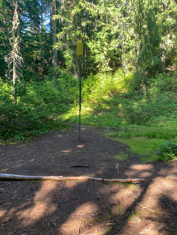
Bear Pole for hanging food at Golden Lakes
Jason was intent on jumping into the lake. I was a little hesitant to make the plunge for reasons I cannot fathom now, but it was the best thing we could have possibly done. We were all still pretty tired from the day before and any weariness was immediately washed away by the cool water. We swam out to the center of the lake and relaxed on a small island, alternately soaking up the sun and cooling off in the water. We were all smiles and repeated, “this is the best part of the trip so far” and “Great idea, Jason.” We emerged after 45 minutes or so, re-energized and ready to take on the rest of the Wonderland Trail.

The Golden Lake behind the patrol Cabin, where we would swim our first time on the Wonderland Trail
After our refreshing dip into the lake, and what was to become a trend for the rest of the trip, we hung out at a patrol cabin porch, enjoying the benefits of a man-made structure; seating and shade. We took turns sitting at the log bench and the steps. We shared our snacks and had the elevated mood of people who have worked hard and now have the opportunity to relax and enjoy their surroundings.
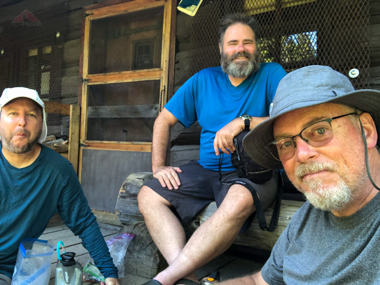
Snack time on the porch of the Golden Lakes Patrol Cabin
We hung some of our clothing in the sun to dry. I charged my solar lantern and battery. We went about doing small chores, collecting and filtering water, and organizing our gear. We perhaps even snuck a nap into the mix.

The largest Golden Lake from our campsite
Since the day was warm and the sun very intense, we found ourselves back at the patrol cabin, sharing stories and just enjoying each other’s company. It was nice having a shorter hiking day, and having this time to soak in the place.
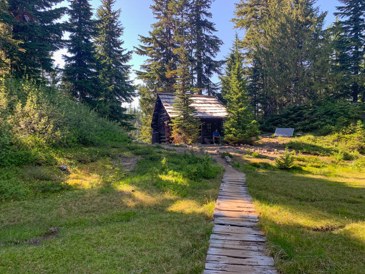
Golden Lakes Patrol Cabin
We had a nice dinner while watching the sunset. The day was warm until the sun went down. We headed into our tents while a squirrel visited me from time to time, peeking into the screen of my tent.
Day 4 - Golden Lakes to South Mowich River
~7.2 Miles
Short days are amazing

Easy Peasy

Our Golden Lakes campsite
We woke up to a cool, thick fog. Everything we had left out to dry was damp, including the outside of my sleeping bag. After a quick breakfast and water run, we loaded up our camp onto our backs and headed out on the trail.

Our Golden Lake in the fog

Morning view from the Golden Lakes patrol cabin

A small Golden Lake not far from the campsite
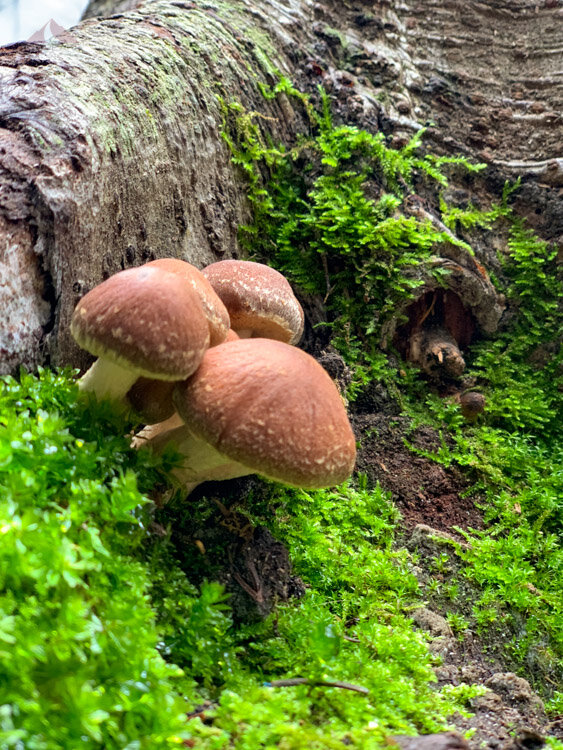
After a short climb, we started descending over the other side. It was a wonderful part of the trail, with a soft blanket of leaves and decaying bark. We cruised right along, enjoying plants with enormous leaves, ferns, and some of the best variety of mushrooms we saw on the trail. Again, we were able to share our stories as we gently descended into the glacial valley.

One of the many mushrooms along the Wonderland Trail

More blueberries on the way down to South Mowich

Blueberries were numerous
While we didn’t have any incredible views, we were able to look at the forest around us and appreciate the small things that we passed as we made our way downward.

More mushrooms along the Wonderland Trail
At the bottom, we encountered the South Mowich River. We scouted for a place to cross, but there was no way to do it without getting our feet wet. At this point, I wish I could have brought my quick-drying trail running shoes, rather than my leather Keens. I had to use my, camp shoes, wool Allbirds, to cross the river. They would be very heavy and wouldn’t dry for nearly a week.

Jeff crossing the South Mowich River

Crossing the South Mowich River on a bridge
It was amazing how much sediment filled our shoes as we crossed. It makes sense not to try to filter the glacial rivers. It would destroy any filters instantly.
Into the trees, we came across the South Mowich River Camp. Since we made such great time on the trail, it was only lunch time. We were the first ones there, so had our pick of the campsites. The trail shelter was available, so we snagged it.

South Mowich Camp Shelter

South Mowich outhouse
We got settled in. For privacy, to keep out the breeze, and to dry my tent, I hung it up in front of the shelter. We had ourselves another relaxing lunch and even got a nap in and it sprinkled intermittently throughout the afternoon.

Summer sausage, aged cheddar and a tortilla

Nutella and a tortilla, will become a staple
What sounded like distant thunder to us was the constant rumbling of large rocks in the South Mowich River, just a few hundred feet away from the campsite. We would hear that sound all night.

Napping at the South Mowich Shelter
Once again, we had all day to relax, wander around the campsite, and greet fellow Wonderland Trail adventurers. We met a group of people doing the trail counterclockwise and enjoyed some conversation for a while. We would be seeing them in about a week. It was nice to not be in a little tent.
Once again, we were able to get a sense of place, as we took in the sights and scents of the forest. A large rabbit came by and there were numerous squirrels.

Jeff Excited for dinner

Happy at South Mowich
It sprinkled on and off through the mist and we enjoyed our peaceful foggy time there. We slept just fine in the shelter and only saw one or two mice. I had an inkling that perhaps I wasn’t eating enough calories as I had nutella on a tortilla for the first time and loved it.
Day 5 - South Mowich River to Eagles Roost
~8.5 Miles
Resupplying is fun

A nice climb
We headed out to another hazy day. The sun was threatening to come out. We hoped it would be out by the time we got to the lake.
We climbed the sometimes steep trail up to Mowich Lake and encountered more day hikers along the way. The forest continued to amaze us with is giant trees and numerous creeks.
Tall trees heading up to Mowich Lake
We popped out into the parking lot and campground at Lake Mowich where there were many people camping. There was a restroom and picnic tables. We headed out along the lake to get our first resupply bucket. There were goodies inside.

The trail along Mowich Lake
We found our buckets and instantly started enjoying some of the calories we had sent ourselves. I shared some Oreos and candy bars and they shared their treats. I was able to hang my shirt over a stump to dry while we had a solid hour of sunshine.

Mowich Lake from the Patrol Cabin
It’s hard to put it in perspective, but our gear was almost constantly wet for most of the trip. My photos were normally taken in the few minutes of sunshine, so there’s no record of the sometimes overwhelming fog that obscured our views and gave us little hope in drying out our gear and clothes. Almost every night for the first part of the trip, we just went to bed wet with no visible stars. Every morning, the clothes on our bodies would be dry and everything outside very damp. After a quarter mile of climbing on the trail, our clothes would be wet again.
Being able to dry something out in the sun was a luxury.

Relaxing and snacking at the Mowich Lake patrol cabin
Our packs full of food for the next 4 days, we headed back to the Wonderland Trail to get to Eagle Roost.

Crater Creek on the way back to the trail
We headed back, passing more day hikers and we sped along, eager to see where we’d be sleeping tonight. We went back into the trees and we were definitely feeling the multiple days on the trail. The uphills sections, even short ones, would slow our steps and encourage small rests.
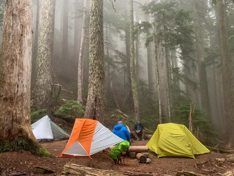
We dropped down into Eagle’s Roost and found a nice campsite that barely fit our three tents. It was hard to tell if it was sprinkling or if the mist was collecting in the trees and dropping on us.
The fog and forest floor muted all sounds as we set up camp and got ready for an excursion to a nearly waterfall.
Eagles Roost Campsite

Jeff on the way to Spray Falls
We hiked out to the falls, and shared them with a family for a while, but then they had to get back to their car at Mowich Lake.
We sat in the mist and roar of the falls for a while, just absorbing the energy that you can only get from being near a waterfall.
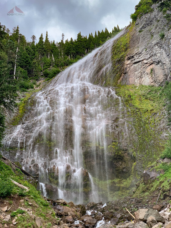
Spray Falls

Jeff, happy to be at Spray Creek
We made it back to camp and settled in to a comfortable foggy evening.
Day 6 - Eagles Roost to Dick Creek
~9.2 Miles
The rain arrives

A challenging profile
We headed out into the mist to hike steeply upward to Spray Park, a variation of the Wonderland Trail. We all had high hopes that we would emerge above the clouds to sunny meadows. While everything around us was absolutely breathtaking, it was shrouded in mist, with the sun only showing itself here and there.

Spray Park

Beautiful Spray Park

Jeff And I Hiking Into a Cloud in Spray Park

Hazy Spray Park
As we were nearing the apex of this part of the mountain, the sun showed itself for about 5 minutes. We all got our cameras out and snapped a bunch of pictures as we sat on a rock for a snack. It was wonderful. The flowers were blooming all around us. This is truly a special place and is on a list of places I’d like to return.
Jeff And I in Spray park with Mount Rainier in back

Mount Rainier briefly peeks out

Spray Park flowers
We headed on upward as the terrain became tundra above the treeline. The sun disappeared and the wind was chilly.
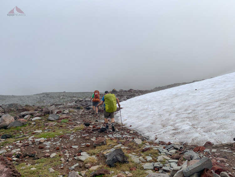
First snow near the top of the Spray Park route

View from our rest stop at the top of the trail
We took a break at the top of the trail. It felt like the Sierra or somewhere in Iceland which I had visited earlier in the year. It was serene with sometimes peekaboo views into the areas below. Jason set up a timelapse video, hoping for Mount Rainier to emerge from the clouds to no avail.
Rested and fueled up, we started our trek ever downward into the Carbon River Valley.

Headed down to the Carbon River Valley
The way downward was an amazing journey through different zones as the plants and terrain changed drastically. Even in the mist, the area is lovely.

At the top of Mist Park, looking back up the trail

Marmot Creek

Wonderland Trail mushroom

The largest slug along the Wonderland Trail
We made it down to a large log near the Carbon River. We refueled and prepared for a climb up to the tiny Dick Creek campsite.

Crossing the Carbon River suspension bridge

Me, going across the Carbon River suspension bridge
We began our climb to Dick Creek on a rocky trail, carved out of many avalanches. I was tired and my mood was low. I’d been wet for days, and my hopes for a sunny day had been dashed again. On the way to Dick Creek, it finally started to rain. When I got to camp, the stakes of my tent, not freestanding, would not stay in the muddy ground. Any rocks to which I guyed my tent would slide along the mud. As a result, my tent sagged at the ends and rested on my face, drenching me with rainwater and condensation. While getting water from the creek, my muddy boots slipped on the rocks, banging my elbow and getting the seat of my pants wet. While we waited in our tents for a break in the rain, my mood sank like my feet did in the mud. Would I ever be dry again?
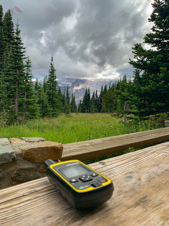
I was also missing my family. This was the longest time I had been away from my daughter since she’d been born and my wife was normally the one traveling. Normally, they help boost me up when I am feeling low. I was able to communicate with them every night through my GPS, but it’s not the same.
The good news is that this was my low point of the trip. Everything else from here was up. I was lucky to be sharing this trip with great friends who helped lift my mood and get me out of the funk I was in. Jason continually shared his hot apple cider with us on the colder days and this was most appreciated.
The rain let up a bit and it was time to break out the beer I was carrying. That definitely was a great way for us to share this moment.
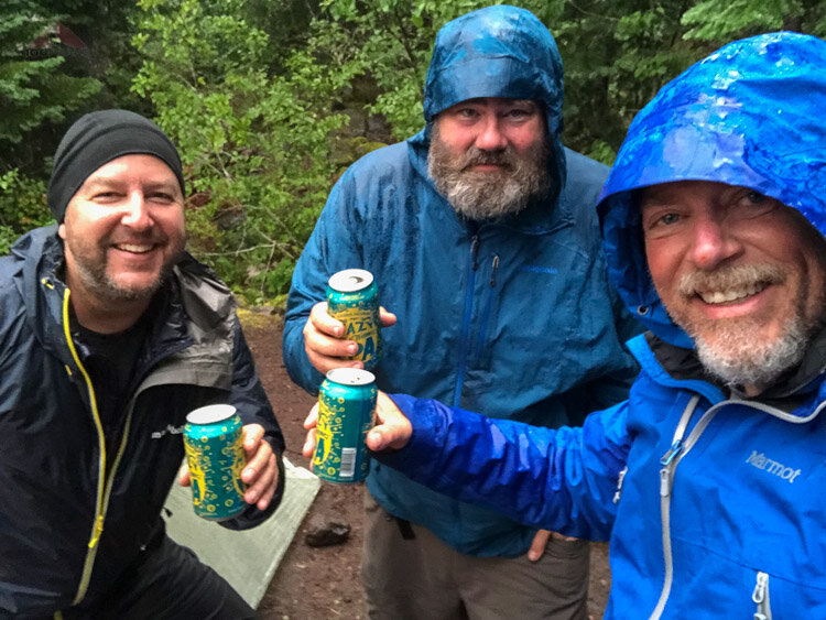
Enjoying some beer in the rain at Dick Creek
During dinner, we were treated with a nice view of the distant sunset. The bats came out to say hello.

A peek down the Carbon RIver Valley from our Dick Creek campsite
Our Dick Creek campsite and me taking the previous picture
I slept a very damp night and the rain came down quite a bit, but was never too cold or too wet in my quilt any night of the trip.
Day 7 - Dick Creek to Mystic Camp
~4 Miles
Always swim in the lake, the sequel

Short but steep
We headed up again through the misty wet forest. I, once again, hoped for a break in the clouds. It was chilly, but the climb initially kept us warm.

Heading up from Dick Creek toward Mystic Lake
As we traveled through the beautiful Moraine Park, I started to get cold. I put on all my layers, but couldn’t seem to get warm. I believe Jeff was also cold. I stopped to eat some more calories, as I was thinking that might be part of the issue. Or the fact that my clothes were soaked. Or the cool breeze that was blowing through the canyon. Or I was very tired. Or a combination of everything.

Crossing Moraine Creek
After swallowing some calories, we headed up, as staying still enhanced the chill. After a while, we started to drop into the Mystic Lake area and it warmed up a little bit. The sun was threatening to come out, but wasn’t really doing it.

Looking for some sun at Mystic Lake campground
We made it around the lake and chose a nice campsite with plenty of places to hang gear. I executed a yard sale, hoping something would dry out in the intermittent sun.
We decided to go to the lake. It was time for a swim.
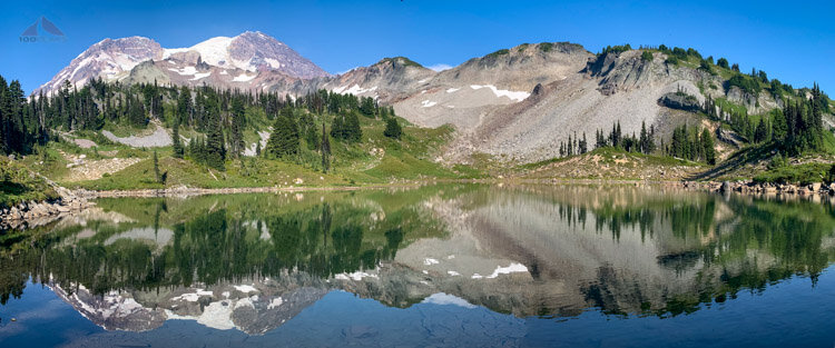
Mystic Lake with Mineral Mountain in the background
We hung out on the shore of the lake, waiting for the sun to make an appearance. The breeze and the water was cool, but it would be a lot better if the sun could warm and dry us.
A few minutes later, the sun parted for us, shining on the lake and letting us see Mount Rainier.

Enjoying some sun and refreshment

Rejuvenating in Mystic Lake
Once again, our mood instantly lifted. We swam around and encouraged other backpackers to make the plunge, to no avail. It’s always totally worth it.
It’s moments like these that are carved into my head as highlights of the trip. As a resident of San Diego, where every lake is a drinking water source, the chances for swimming in a lake are few and far between.
After the swim, we hung on out grassy shore in the sun that came and went, waiting to warm up and for some of our things to dry. We took some snacks and headed to the Mystic Lake patrol cabin, where once again we enjoyed some shelter, some sun, some company, and an intermittent wonderful view of Mount Rainier.

The view of Mount Rainier from the Mystic Lake Patrol Cabin
The sun left us for the day as we went back to camp and had dinner. At sunset, Jason and I headed back up to the lake in the hopes that we’d get a glimpse of the sky. There were some promising moments, but nothing appeared in the clouds as the daylight slowly faded over the foggy lake.

Hazy Mystic Lake
For more than an hour, Jason and I enjoyed the quiet lapping of Mystic Lake. Again, the fog shrouded everything, including our voices. There was peace in the silence, with nothing moving except the ripples on the lake.
We once again went to sleep dreaming of a sunny day.
Day 8 - Mystic Camp to Granite Creek
~4.6 Miles
The prettiest little creek

Down to the foot of Winthrop Glacier and back up
Mount Rainier view from the Wonderland Trail
We woke up to see sunlight shining on the southern slopes of Old Desolate Mountain. We looked up to see the sunlight at the tops of the tall trees, far above us. There were clouds on the horizon, but, for now, the sun was coming.
Excited, we headed out for the day, dropping elevation to the foot of the Winthrop Glacier. On the way, we passed a hiker who recognized Jason. One of many on the trail. He hiked with us for a while until we took a nice break at Garda Falls.
The sun made all the difference.

Taking a break near Garda Falls
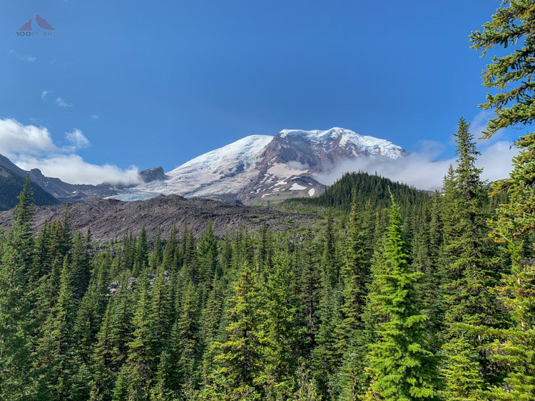
The trail rounded a corner at the foot of the glacier and began heading uphill again. On our right, Mount Rainier rose high above the moraine.

Mount Rainier View from the foot of Winthrop Glacier

Heading up the Wonderland Trail to Granite Creek
With a relatively short day, we arrived at Granite Creek Camp well before lunch. We had plenty of time to hang around camp and the creek and chat about everything. The sun came out for a few minutes here and there. It was the one day where I wished we could have had a campfire.

Granite Creek
Jeff had a solid nap while Jason took long exposure photographs of Granite Creek, which is a pretty little creek with dark rocks and green moss. The water was crystal clear.

5 minutes of sun was enough to soak my feet
The hunger also started setting in. More and more, the talk turned toward food. We were headed to the Sunrise Campground tomorrow and we all had dreams of a meal at the grill.
Mushrooms at Granite Creek campsite

Privy at Granite Creek
We fell asleep with images of hamburgers in our heads.
Day 9 - Granite Creek to Sunrise Camp
4.4 Miles to camp, ~6.5 Miles total
Food

Sunny at the top

Heading up toward the Sunrise Wilderness Information Center
We woke up to another sunny day, but were in the shade as we climbed up the Granite Creek basin. As we neared the top, we could sense a change in the air.
It was dry. The humidity of the rainforest on the western and northern flanks of Mount Rainier was gone. This felt like the Sierra Nevada. The trees gave way to granite and the view exploded in front of us.

Mount Rainier pano from Skyscraper Pass
We made it to Skyscraper Pass, one of the high points of the trail. We took off our packs and enjoyed the view for miles in every direction. We started to see more people who were out on day hikes from Sunrise.
We soaked up the sun and took a million pictures with smiles on our faces. The sun was warming and drying us, we had mostly downhill for the rest of the day, we were resupplying, and we were going to be having some hot non-dehydrated food for the first time in over a week. And sit in a chair.
Needless to say, our mood was high.

Looking down the Lodi Creek drainage from Skyscraper Pass

Mount Rainier from Skyscraper Pass

This guy is happy
After a long time, we aimed ourselves toward the Sunrise Wilderness Information Center. We entered Berkley Park, an enormous bowl of green. The hikers were numerous as we headed like horses to the stable.
Berkley Park pano
We dropped to Sunrise Camp and selected a nice campsite with plenty of sun. I made another yard sale and this time my clothing actually dried. For the first time since day 4, I was able to change out of my hiking boots into dry camp shoes. It was wonderful.

Almost to Sunrise Camp
Almost immediately, we headed to the Wilderness Information Center, another mile or so away from the campsite, which seemed like a very long distance when there was food at the end of it.

The view of Mount Rainier from the trail to Sunrise Visitor Center
We ate lunch at the grill, grabbed our resupply buckets, and then hung out all afternoon, charged some batteries, bought some snacks for later, communicated with home, and waited to get hungry again and then ate dinner at the grill before heading back to camp.

Derek's Lunch Beer

Jeff's Dinner Beer
There was a tense moment when my resupply bucket was not in the bin with the others. I started trying to figure out what my plan would be. There was some free food people left behind and I could resupply at the gift shop, but it wasn’t ideal.
Communication with home
I went back to the visitor center and the person at the desk made some phone calls. My bucket had been driven from White River to Sunrise, but no one knew where it was. She checked a closed office down the road and there it was. She said it was put aside since there wasn’t an exact date of pickup on the outside. I explained that I was a walk-in and I had no idea of knowing what my date was going to be when I mailed it, so had a date range. She wasn’t sure how to avoid something like this in the future.
And I had three more beers in my food stash to share with my friends on the next part of the adventure.
I thanked her profusely and she said we may be seeing each other in a few days, since she was hiking out with a friend to a camp to the south.
Full of two hot meals, we headed back to camp and walked around Shadow Lake and hung out until the third star appeared in the sky.
Shadow Lake

View from the Sunrise Campground
Day 10 - Sunrise Camp to Summerland
~10.8 Miles
Getting to Paradise

Down and up

Our Sunrise Campsite at dawn
Fully fueled and weighed down with enough food for the last leg of the trip, we left our comfortable campsite and headed out on the trail toward the Wilderness Information Center. We passed some deer in a meadow and then went back on the Wonderland Trail, dropping like a rock to the White River Campground with the majestic Mount Rainier high above us. The switchbacks were easy on the soft forest floor as we chatted our way down toward the sounds of cars and the scent of campfires.
We passed our friends that we saw days before at the South Mowich campground and shared our stories from the days between. We wished each other luck and went our ways. They were almost out. We still had a few more days.

Deer in the meadow near Sunrise
The day was sunny and our mood was high. White River campground was a hive of activity as many car campers were finishing up their breakfasts for the day. We took a break on the porch of the historical cabin. Cabins and shelters were a habit at this point.

Good morning, Mount Rainier

Historic Patrol Cabin at the White River Campground
We then headed out across the White River, which was flowing up against the bottom of the log bridge. It’s possible that later in the day, there would be no crossings due to high flowing water.

Crossing the White River with high water
What followed for the next few miles was a pleasant, relatively flat trail as we hiked around and entered the Fryingpan Creek drainage. It was bizarre to be able to hear cars driving on the road below us. Jason was able to get cell service and it turned out he likely had a job waiting for him after the trip. There were definitely more people on the trail, mostly day-hikers, but a number of people backpacking upward toward Summerland. We hiked from about 6,300’ at Sunrise, down to about 4,000’ and then had to start the trek back upward to nearly 6,000’.

Nice flat trail for the first part of the day while heading to Summerland
The next 4+ miles were a steady uphill climb through amazing meadows and views above. It was at this point that I got the aria Habanera from the opera Carmen stuck in my head as a rhythmic mantra. It was a perfect tempo to keep me trucking up the often steep climb, as the trail switched back and forth over the drainage. We stopped at a nice creek and I immediately took off my shoes and soaked my feet, another joy I had along the trail.

Foot soak near Fryingpan Creek
This part of the trail was impressive. It was very lush with flowers blooming all over the place. Above us was the moraine of the Fryingpan Glacier and at our feet was an amazing amount of plants and flowers. Butterflies and creeks were everywhere.

Crossing Fryingpan Creek

Getting closer to Summerland
We topped out into a green meadow and made it to the Summerland Trail shelter. Two backpackers were enjoying their lunch and we stopped and chatted with them for a while as we made ourselves at home in this luxurious structure.

Our luxurious group trail shelter at the Summerland Campground

The beauty of Summerland
Jeff went down to get some water while I rested above, hanging some clothes on a fallen log nearby. He came back and recommended that I come and take a look. We went down to the stream running in the middle of the rolling meadow and I was struck speechless with the scene around me. Mount Rainier stood 8,000’ above me, as I soaked my feet into the icy stream. Flowers swayed in the breeze as I took in the granite, grass, and snow.
It was absolutely lovely and reminded me of why this trail was named as it was.

The heavenly Summerland, complete with flowery meadows, crystal clear streams, and a view of Fryingpan Glacier on Mount Rainier

Best soak ever

Looking down toward Fryingpan Creek

Headed back to the shelter
We sat there for a while, repeatedly exclaiming how nice this was, as the clouds and the scent of flowers flew by above us.

Our view from the shelter - Panhandle Gap is to the left
We made it back to camp, where Jason had met a bunch of other backpackers who were staying in Summerland and invited them for a birthday party for Brian, a Nevada firefighter tackling the Wonderland Trail on his own. We settled in and shared stories, 10 people from all over. I gave one of my beers to Brian, wishing him a happy birthday.

Birthday party at the shelter
It was a special moment on the trail. We laughed and shared our versions of the past few days, talked about mushrooms and tequila (the latter which was passed around shared). It was about an hour of friendly heartwarming camaraderie.

The group photo at the Summerland group shelter
As the sun started sinking, everyone was ready to settle in for the evening and headed back to their respective campsites. Jason and I stayed up a little later again, chasing photos. The moon was peeking out from behind the Pandhandle Gap, and I communicated with my wife using the GPS, looking at the same moon, but 1,200 miles away from each other.

Moonrise from inside the Summerland trail shelter
Day 11 - Summerland to Indian Bar
~5 Miles
Moving from One Paradise to Another

Up, down, up, DOWN

Sunrise from my quilt at the Summerland group shelter

Jeff took this picture of Jason and me, while we were still snug in our bags. I had just taken the previous picture.
We woke up to the sun glowing orange on the granite cliffs on the other side of the valley. I was excited for a short day and curious to see what was ahead of us. We were to head out and go over Pandhandle Gap and then drop down to the Indian Bar campground, where we would be able to sleep in another shelter.

The Summerland group shelter from the side
We crossed the beautiful creek from the day before, climbing upward as the greenery changed into granite. We were in an alpine environment again, and there was water flowing everywhere, surrounding us with sound. It was a gorgeous sunny day and the air was wonderful.

Cascades on the way to the Panhandle Gap
Everywhere we looked, there was beauty. There were cascades, flowers, sweeping green mountains, turquoise tarns, snow fields, bubbling creeks, and imposing granite peaks.

Flowers and snow

Turquoise tarn near the Panhandle Gap

Crossing snow, the Panhandle Gap is just on the right
I stopped for a bit to watch a couple of pikas noisily chasing each other around the granite boulders.
We arrived at the Panhandle Gap and were greeted by high winds and a sweeping view of the Ohanapecosh drainage. We could see Mount Adams, miles and miles into the distance. We hiked down a hundred feet or so to get out of the wind and took a nice break. There wouldn’t be very much more uphill for the day.

The view from Panhandle Gap all the way to Mount Adams in the distance
We had met a group of retired women during the party the day before and they were hiking along with us. They were having a blast and their enthusiasm was contagious. We arrived at the Panhandle Gap at about the same time. We hung out together for a bit until they spied one of the peaks that flanked the gap. Before long, they were set on climbing it. We waved goodbye and wished them luck.
I hiked down to the edge of a drop-off to get some photos. At this time, the Ranger from the Sunrise Wilderness Information Center, who helped me find my resupply bucket, came hiking by with a friend. She recognized my backpack, but hadn’t seen me. We said hello and I thanked her again and she headed out, as she had a long way to go before she would be done for the day.

Crossing some snow on the way down to Indian Bar
We dropped some elevation, hiking over tundra-like terrain with occasional snow patches. There were plenty of creeks and grassy hills. Once again, the Wonderland Trail showed us a new side.

Looking toward Ohanapecosh Park
We hiked up and over some rocky terrain and started losing elevation quickly on the other side. There were jaw-dropping views everywhere we looked. As we dropped over 1,500 feet into the Ohanapecosh drainage, I stopped repeatedly to take picture of the views.

Dropping down the ridge to Indian Bar

Jason is grateful for some downhill

The breeze brought the smell of lupines up to us from below

Dropping to Indian Bar
The trail dropped quickly until we got to the glacial Ohanapecosh River with our shelter on the other side. We crossed another wooden bridge and hiked up to the shelter, nestled above the river with a sweeping view of the valley below and the mountains beyond. This was luxury. The group camp even had its own toilet.

The Indian Bar group shelter
We got settled, and went down to the river to clean up ourselves and our clothes. We went back to the shelter to hang up our gear and put our clothes on the rear roof of the shelter to dry. This shelter even had beds hanging from the side of the shelter.
Since it was such a short day, we had plenty of time to relax in the shelter, getting a little chilly in the shade and then warming up in the sun. We watched the butterflies fly around us and backpackers inching along the trail on the other side of the river.
During these times, our friendship with each other grew, as we shared more and more of our experiences and thoughts about the world. The trip was getting nearer to be done, so we squeezed everything we could out of this day and this beautiful location.

Enjoying our time at the Indian Bar Shelter

Luxury sleeping arrangements

Indian Bar shelter sign

The view from the Indian Bar shelter
We chatted with another hiker who was hiking the Wonderland Trail on her own and she joined us for snacks as we whiled away the afternoon. Jason got some great timelapse footage of the clouds moving over the mountains. We chatted away until the light grew dim and the shelter mice came out to play.
Day 12 - Indian Bar to Maple Creek
~10.6 Miles
Back into the forest, almost home
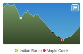
A little bit of up and then down down down

Headed up the Cowlitz Divide
After having a few days of sun, we woke up to a cloudy morning and set off into the fog. We hiked along the Cowlitz Divide, which from what I hear has amazing views in either direction. On this day, we were embraced by the fog and were surrounded again by flowers. The greenery was lush and once again we stopped for blueberries as much as possible.

Hazy lupines on the Cowlitz Divide

More blueberries along the Wonderland Trail
We dropped about 2,500 feet of elevation as we weaved in and out of flower-filled meadows and lush forests. The trail was, as usual, soft under our feet and well-maintained. We saw more hikers as we dropped closer to the road. We encountered more friends from the party at Summerland and hiked with them for a while.

Creek crossing
We had a short break at a restroom area along Box Canyon. We actually had running water! We peeked into the Box Canyon and took a detour under a bridge before we dropped back onto the trail.

Box canyon
We crossed Stephens Creek, getting to our campground at Maple Creek. We selected one that was roomy enough for us. We even had an eating area in the middle with stumps for tables. Our talk, more than ever, turned to what food we would eat. We shared more conversation about our respective histories and how we got where we were. It was a pleasant campsite in the lush forest.
Stevens Creek
I headed down to Maple Creek and found a rock near the water. For the last time on the trip, I soaked my feet into icy cold water. I sliced some cheese and summer sausage onto a flour tortilla and enjoyed my lunch after nearly 11 miles on the trail. I connected with my wife over the GPS from time to time and enjoyed the quiet solitude near the creek. More than ever, I was able to attune myself to wherever I was, to absorb the sense of place. To enjoy the moment. Tomorrow, I would be back into the “real” world, but for now I was here.

My snack and soak spot on Maple Creek near the campground
We went to sleep with visions of food, a shower, and a comfortable bed.
Day 13 - Maple Creek to Cougar Rock
~9.3 Miles
Back to the car
Actually to Cougar Rock

Enjoying the view of Sylvia Falls
We woke up and packed our things for the last time. Our packs were light and there was a spring in our step. We cruised along the carpeted forest and scrambled away across an avalanche area. Steven’s Canyon was below as we started to hear cars again. We encountered day hikers and several waterfalls. Even this close to the car, the trail still showed us the wonder.

Hiking along Stevens Canyon

Snack break at Martha Falls
We had a snack break at Martha Falls and I checked my food bag. I only had one more bar. I had under-packed a little bit and had to rely up some food from my friends. I hadn’t been planning on 13 days when I mailed the buckets.

Martha Falls
The trail would meet the road, sometimes crossing it, as we wound our way along the southern end of the park. We encountered a lot of people driving to viewpoints for pictures, as well as day hikers. We also met a couple who were setting off on the entire Wonderland Trail. They had a lot of questions, so we chatted with them for a bit, and they even hiked with us for a while.

Reflection Lakes Pano

Final Snack Break
We had our final snack break at Reflection Lakes, where I had the last of my food. We were once again all smiles and excited to be near the end.
We dropped down into the forest, meeting more hikers along the way. I stopped to eat blueberries as often as I could, even though the car was but a few miles away. I didn’t know when I would be able to do this again. I was eager to get back to the car, but was also savoring the trail. I looked at every leaf and how the water would bead on the surface.
In a burst of noise we came out to the Nisqually River. A simple river crossing and we’d be back at the car. We had to wait for a bit for a family to take selfies on the bridge, but in no time we were across and hiking back up the road and to the car.

Nisqually River - the final river crossing to the car
We washed up in the restroom and congratulated ourselves. It was quite an accomplishment for me and we all felt like it was a success.
We headed up the road, intent on pizza. We also had a great dinner and spent a comfortable night in a hotel before we headed home.
Happy to be at the car
Like most adventures, the crux of the value is the experience we are able to share and this was no different. We shared our frustration and joys, the beauty and campsites. We shared our food and gear, and took turns getting water for the group. We shared encouraging words when things got frustrating and our amazement when things were incredible. From the tiniest mushroom to the widest view, it was a wonderful experience and I was glad I could share it with my friends, Jason and Jeff.
There will be many more adventures to share in the future, but this one was pretty cool.

