


Clevenger Canyon North Viewpoint - Peak #73
Clevenger Canyon North Viewpoint
Elevation: 1,727’
Total Mileage: ~4.9
Trailhead: Clevenger Canyon North Trailhead
Agency: City of San Diego Park and Recreation Department
Official Trail Map: City of San Diego PDF
Date Hiked: 04/29/2016
Peakbagger.com Page
For those interested, here is a list of my gear that I have found works well for me. This is, of course, an affiliate link and your enjoyment of these may vary:
04/29/2016
It was a warm day when I pulled up to the trailhead on the north side of the 78. I had hiked Clevenger Canyon South a couple of times, but I had never been on this side.
I parked at the trailed on the north side of the canyon. The gate was closed, even though I had gotten a late start and it was already 9:30AM. I made sure I wasn’t blocking the gate.
This is a good trail to get an early start, since there isn’t much shade along the way.
As I got my backpack and shoes together, I took a look at the climb ahead. The mountain looming across the creek bed below loomed large above me, but I knew the mileage one way was less that 2.5 miles.
However, gaining ~1,200’ from Santa Ysabel Creek to the highest point on the way to the viewpoint in 2.14 miles could get a little steep at times.
From the trailhead: The Way Up the North Side of Clevenger Canyon
The trail quickly dropped into the rocks below, which clearly showed the signs of proximity to the road: litter and graffiti. I thought this area would be nice on a sunny day when the creek was flowing. At the time of the hike, the creek was very dry. This would be the last shade I would get on the trail until the return.
I crossed the creekbed and started the climb.
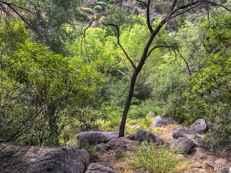
Santa Ysabel Creek: Riparian Zone after the first dip in the trail
The trail swung wide to the west and then to the east before the switchbacks tightened up a little bit. To the east, I enjoyed views into the sometimes bushy and sometimes rocky drainage coming down from the mesa above.

After the creek. heading back up the North Side of Clevenger Canyon
As the trail rose, mostly criss-crossing the face of the mountain, I started to get views to the west, which is of the citrus and avocado orchards on the valley floor.

The view west into San Pasqual Valley from Clevenger Canyon North
The trail then got a little rocky and there were a lot of use trails from people either exploring the rocks or simply cutting the trail. I got a little sidetracked, but was able to find the proper trail in short order.
There was one slightly unnerving section where a large boulder leans over the trail. I scooted quickly along that section. Just in case.

Looming Rock on the Trail up Clevenger Canyon North
As I got near the viewpoint, I decided to continue on the trail to explore a little bit. The trail continued on for a while, but then disappeared into the brush. I did find some flags and markers here and there, but mostly it was bushwhacking while following a very faint trail.
I ended up high on a knoll near the private property line of Rancho Guejito with really no better view than the viewpoint below.
Exploring near the top
I descended back down to the giant boulders, skirting clockwise around the northern side of them and found a nice large flat boulder to enjoy my lunch, the breeze, and the wonderful view of the canyon below. I could see all the way to Cuyamaca Peak.
The view down into San Pasqual Valley from Clevenger Canyon North
After a nice long lunch, I made my way back down to the car, with a short little climb on the other side of the creek.
Clevenger Canyon North Trail Map (Click to enlarge)

