Big Black Mountain - SD Peak #70 - My first section hike
Big Black Mountain
Elevation: 4,051′
Miles: 14.2
Trailhead: Big Black Mountain Trail Trailhead
Agency: Cleveland National Forest
Dates Hiked: 03/17/2015, 04/18/2018
Peakbagger.com Page
For those interested, here is a list of my gear that I have found works well for me. This is, of course, an affiliate link and your enjoyment of these may vary:

At the trailhead to Big Black Mountain in Pamo Valley
Section hiking: hiking a trail one section at a time, without continuity and not necessarily in sequence with the other sections.
While section hiking usually refers to a method of completing longer trails, like the Pacific Crest Trail or the Appalachian Trail, this time I was forced to do it in San Diego, while heading to a peak normally completed as a day hike. Big Black Mountain, granted, is a long hike. From the bottom of Pamo Valley to the summit and back, it is a 14.2-mile hike. However, since the road is a fairly passable dirt road, one can make the hike as short as a half a mile, should one choose.
Update 2018: I have since run the entire road and trail as a trail run. It was a wonderful time on the mountain.
Big Black Mountain- Day 1
03/06/2015
Given the infrequency of my hiking schedule these days, I had decided to drive part way up Black Mountain Truck Trail and find a good place to pull off the road and take it from there. I was aiming for a 5 to 7 mile round trip hike. However, due to my lack of preparedness, I hadn't checked the Cleveland National Forest website before I left.
I arrived to a closed gate.

The gate was closed
Sitting in my car at the trailhead I tried to decide what to do. I double-checked the website on my phone and, sure enough, the site read that the gate was closed. I should have checked. I didn't want to be gone all day. I left fairly early for this hike so I could be back by lunch time. I had stuff to do.
I thought a bit for a plan B, but really this hike was my plan B. I had originally thought of spending the night last night in Anza Borrego and knocking off 4-5 peaks in the area and driving home, but I chose not to do that. As I sat in my car, I realized didn't have any other trail beta prepped.
To the tune of cows and turkeys, I emailed my wife the following:
The gate is locked on the road, so that brings the distance to the peak to 14 miles. Will just hike up the road a while and find a pretty spot to turn around. I need to work up to 14 miles. I'll save it for next time.
It's pretty out here. But 34F. It's cold.
I'll let you know if I'll be back before lunch.
I headed up the trail, enjoying the cool morning air and how green the valley was.

An Englemann Oak along the trail
The dirt road wound slowly up the mountain. It was immediately clear this was a dirt road with vehicle access, since I started finding all sorts of trash by the side of the road. I found plenty of beer cans, spent shells, and even a dartboard. Near some "No Shooting" signs, there was a full target range, littered with broken glass and whatever people brought up here to shoot into tiny pieces.
Near a "No Fires" sign was a fire ring with blackened ash and wood in it. I wasn't going to let rude behavior get me down, so I continued up and up. I found an oak tree next to the trail and rested in the shade. The day was warming up quickly.

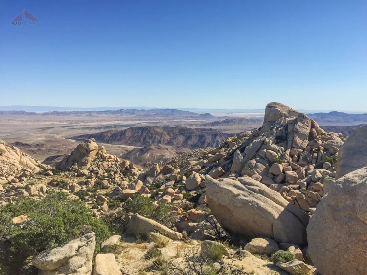
Pamo Valley and beyond from the trail to Big Black Mountain
Flowers bloomed along the trail as I continued upward, wondering where a good turnaround point would be. My curiosity got the better of me. I kept going, and going. The trail wound to the west and I got a great elevated view of Pamo Valley. I hiked a little further until I came to a large turnout and a little hill to the west. I checked my phone. I had gone well over 5 miles.

Plently of poison oak along the trail
I texted my wife that I wasn't going to be making it for lunch. I was a little tired, though. The climb was pretty steady and I still wasn't in prime hiking condition. I sat on some rocks and had lunch. Once again, I had a mountain to myself, but I hadn't made it to the top. Getting to the top would be adding between 3 and 4 miles to the day. I decided to turn back and complete the mountain another day.
Only taking a single break on the way down, I came back to an unlocked gate. The ranger had come around to unlock the gate while I was on the trail. I wish I would have known that would have happened.

The gate was open when I got back
I was tempted to hop into my car and drive up near the top, but I knew that would take more time than I had. I resolved to come back and complete the hike another day.
Big Black Mountain- Day 2
03/17/2015
About a week later, I was driving my daughter to school and suddenly had the urge to complete Big Black Mountain. I thought about the gear in the back of my car. I had everything I needed. I dropped her off and away I went, winding through Ramona to get to the trailhead. I was happy to see the gate still open and drove my car upward.
The road was nice, with only a few spots that required some attention. It took a while to get to the spot where I turned around the week before, but compared to hiking it, it was a blink of an eye. I got my gear on and headed up. It was a warm day, but there was a cool breeze. The rest of the week was destined to be 90F or greater, so I was happy to be on the trail this day.
The dirt road continued to wind higher and higher. I came across Black Mountain Spring and its large cistern. I scrambled to the top of it, avoiding some poison oak, and lifted the cover and looked inside. I have heard this called a perennial spring, and this is likely the case. The large spring box was filled to the top. Filtering the water inside would provide an excellent source of drinking water. And a frog thought so, too, as it scurried out from under the lid and watched me carefully.

The Black Mountain Spring box

Plenty of water and a frog in Black Mountain Spring
I passed a gate to my left which led to an inholding and before long, I was at the end of the road. There is a large turnaround there and a trail led north toward some trees.

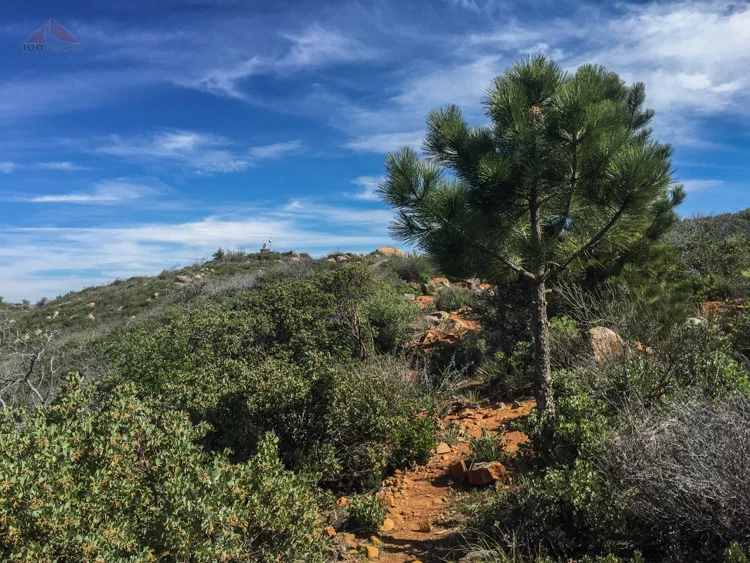
Leaving the fire road and hiking on a trail for the first time
I had to climb over a fallen tree, but it was nice to actually be hiking on a trail and before long the summit of Big Black Mountain came into view. There was some equipment on top, but it provided some shade on the west side. The view was excellent. Lizards and butterflies moved around in the cooling breeze.

The summit of Big Black Mountain comes into view
Once again, I had the top of a mountain to myself. I sat and had lunch, realizing that it had been since early November, nearly 5 months, since I had summited a new peak.
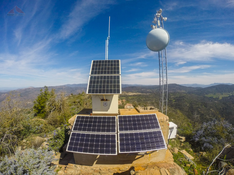
Solar and antenna array at the top of Big Black Mountain
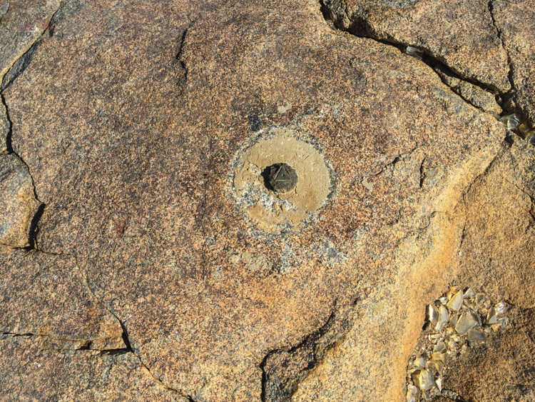
Evidence that this benchmark was too close to a road

At least a portion of the foundation of the now gone lookout tower on Big Black Mountain was poured in 1958
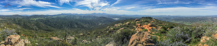
Big Black Mountain offers an excellent view to the south
I felt a little silly that it took two hikes to get here, but I did it, fair and square.
As they say, hike your own hike.

Big Black Mountain Trail Map (Click to enlarge)