Square Top - San Diego Peak #67 - Celebrating Brian's 100th Peak
Square Top
Elevation: 4,649′
Distance: 8.4 miles
Agency: Anza Borrego Desert State Park
Date Hiked: 04/05/014
Peakbagger.com Page
Update: As of 2019, the access from the south through the Los Coyotes Indian Reservation is no longer accessible to non-residents. The route I took is no longer available. Others have done it from the east and have reported it is very challenging.
Therefore, Square Top has been replaced with Oriflamme Mountain, due to no access through the Los Coyotes Reservation.
For those interested, here is a list of my gear that I have found works well for me. This is, of course, an affiliate link and your enjoyment of these may vary:

Square Top, looming above us
04/05/2014
When I got invited to this hike, I felt privileged. I have been following Brian's progress on San Diego Peaks for several years on Google+, but I really didn't know him. His frequent summits all around San Diego County left me homesick for home, as I have been living in Santa Barbara since October 2011. I initially replied that I would be there in spirit only.
However, the Monday before this hike, I got laid off from my job. More on this in a later post. But my wife asked me, "What would you like to do this weekend?" I responded that I wanted to head down to San Diego to be with family. And I also wanted to join Brian in his finishing the Sierra Club San Diego Peaks list. I emailed Brian to let him know that I would be there. I was excited, since I saw Square Top from the top of Hot Springs Mountain, back in 2009.
After arranging a ride from a friend of Brian's, we headed out through Ramona and north past Lake Henshaw to Warner Springs to get to the trailhead. It was pretty chilly and windy as we got out of the cars and got ready for the trail.
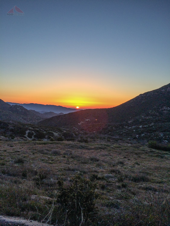
Sunrise over the desert on the way to the Square Top trailhead
We descended on the dirt road that eventually turns into a trail that meets up with Cougar Canyon. As we kept on losing elevation, I started to wonder what this was going to be like, on the way back, in the full sun.

Dawn on the way to Square Top
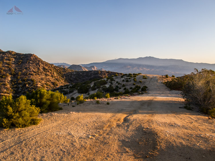
The dirt road portion of the trail
Cougar Canyon was pretty green and had a nice running stream in the bottom, which we crossed several times. We all chatted about all sorts of things, while I struggled to get my wind. I was wondering how well I was going to manage this day. I had gone on a steep ridgeline hike and a 33-mile backpacking trip to Montgomery Potrero in the past few months, but nothing regularly lately. I shrugged it off to lack of sleep and kept going.
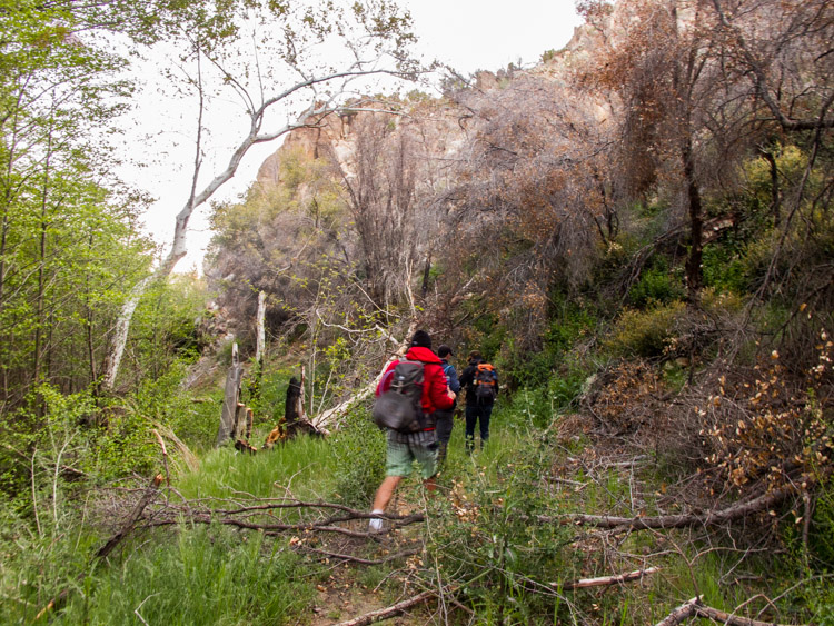
Hiking through Cougar Canyon

Happy hikers in Cougar Canyon
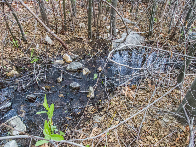
Plenty of water in Cougar Canyon
We continued to descend out of Cougar Canyon and finally entered what I would call desert. We were following what was an old dirt road. It was so unmaintained that it was hard to believe that any vehicles had ever driven on it.
We stopped for a bit to have something to eat. I didn't have my usual routine, which was to have some coffee and breakfast before I headed out. Perhaps this was why I was struggling a bit. I had a couple of bars and downed plenty of water and felt better.

On the boundary of the Los Coyotes Indian Reservation
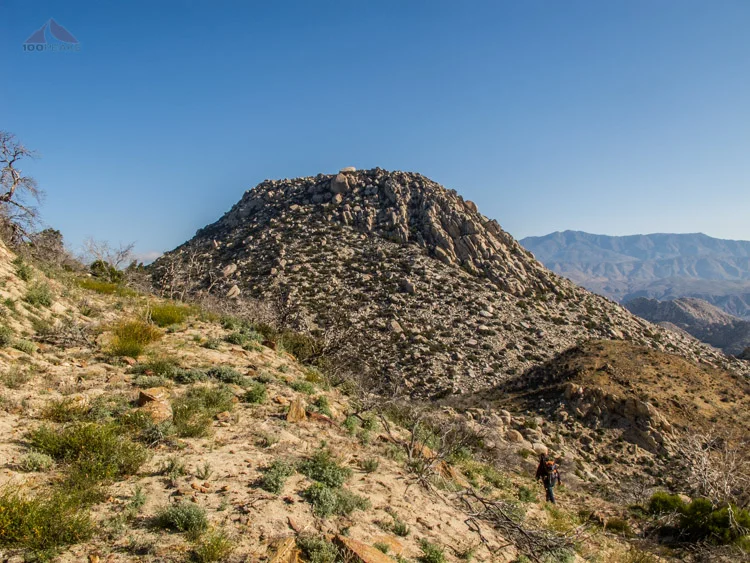
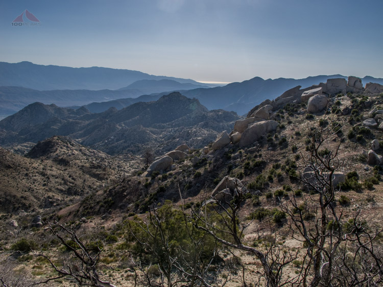
Square Top in the distance, behind the center knob
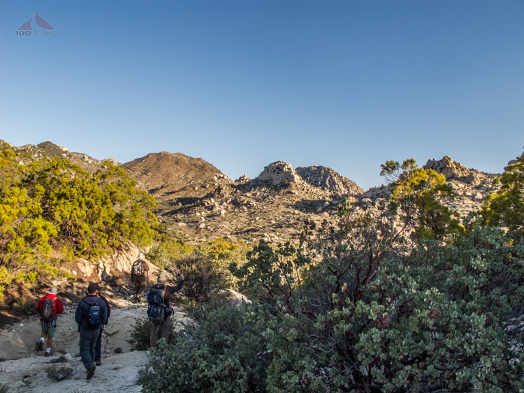
After crossing another stream, we headed up the right side of an unnamed brown mountain, seen above. With any steep uphill sections, I instantly was winded.
My legs were fine, but my lungs couldn't seem to keep up. One of the other hikers was gracious enough to slow down with me. When we rounded the corner, Square Top came into view and I understood that I would have to dig a little deep to complete what I wanted to do today.
We descended down to Sheep Canyon, which also had plenty of water due to some recent rains. As we started up the other side, I felt once again like I was tackling a 14er.
Never one for speed, I placed one foot in front of the other, sliding down into the sand occasionally as I slowly ascended the steep flanks of Square Top. I could hear the others far above me as I continued my steady climb.

Plenty of water in Sheep Canyon
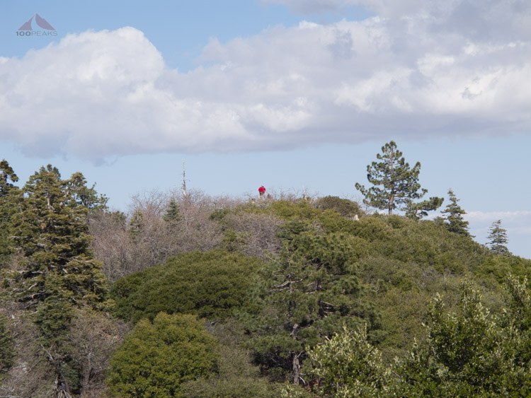
Eventually, we all met up at the summit proper while some of the group attempted to summit a large boulder that was the actual high point of the mountain.
I was very content to relax on a large flat boulder, having some snacks and sharing stories with my fellow hikers. We offered congratulations to Brian, who held up a small sign and beer was passed around.
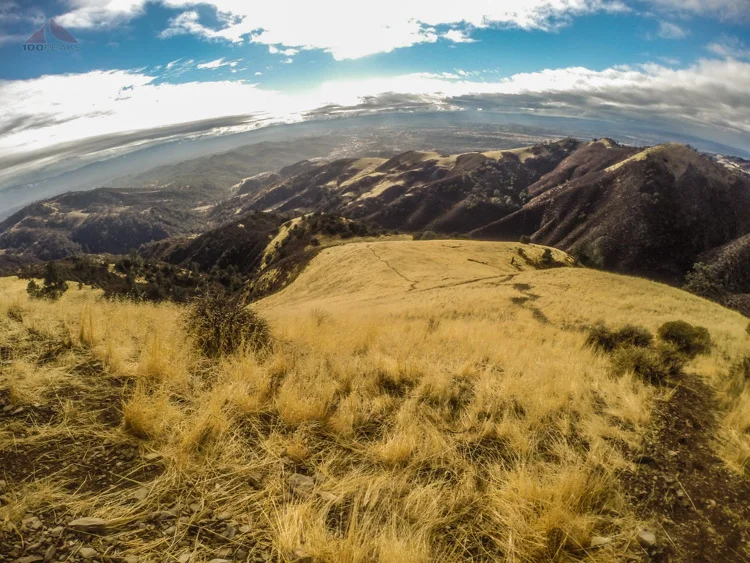
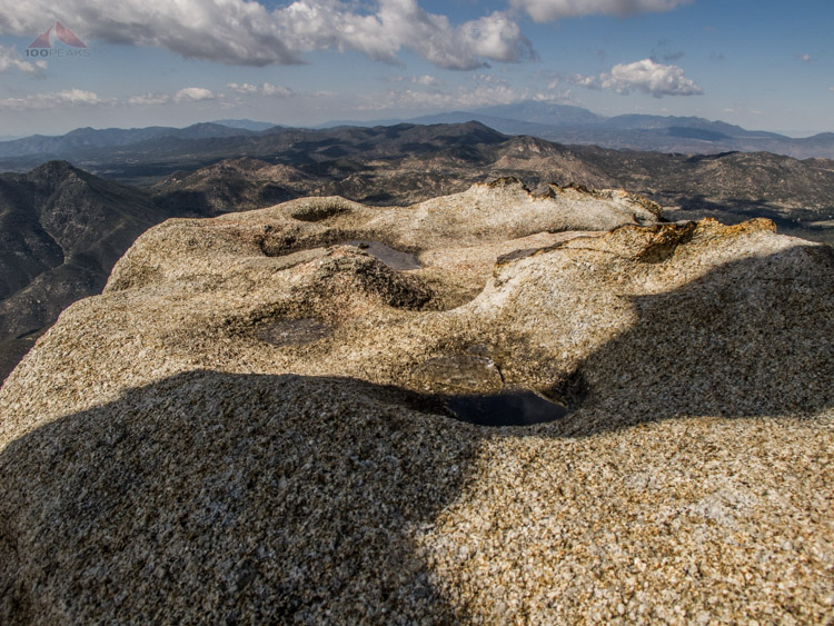
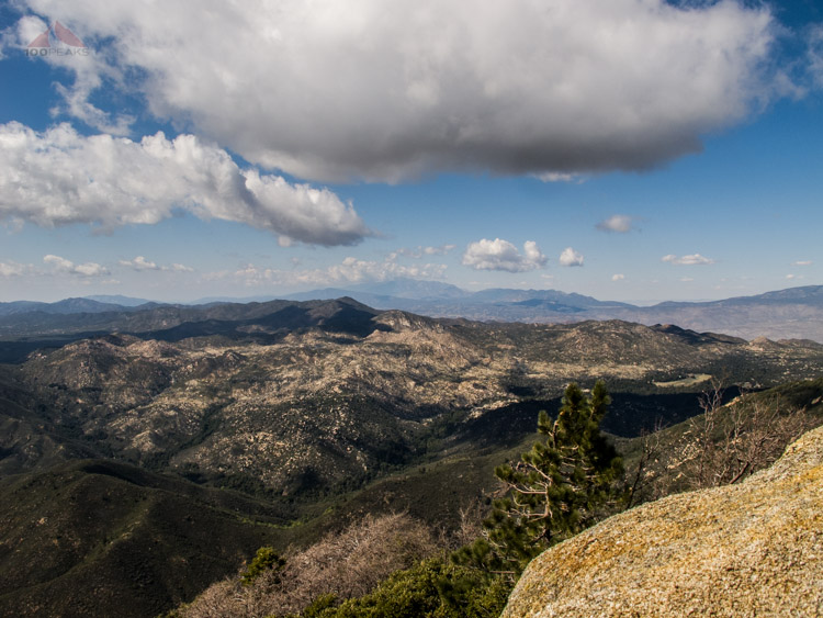
The views from the top were very nice, as the day was fairly clear.

Brian's 100th San Diego Peak on the Sierra Club List

Clark and Collins Valleys
The view to Salton Sea
After a while, we headed back down the steep side of Square Top, nearly skiing in the sandy ground. I was feeling a little better, maybe it was just some calories I needed. We rounded that brown mountain again and one of the group pointed out a horned lizard, sitting still off the trail. I would never have seen it had he not pointed it out to me.

Horned Lizard, barely visible
I was feeling good. The sun was warm, it was a beautiful morning. I started feeling like I could make some good time hiking. Then I reached the steep dirt road on the way back to the car and hit a wall.
I started my "counting to a hundred" trick while hiking. I would count out 100 paces then catch my breath. The day was getting hotter and hotter. I drank more water. I barely caught up to another hiker and offered him some of my water, since I had plenty and he had run out.
The road continued to gain elevation and I hadn't hiked nearly this distance in months. I was the straggler, which hasn't happened to me in a long time.
I can only chalk it up to about two months of the flu, and then a cold, and a very busy traveling schedule over the past few months. More proof to me why I need to hike more regularly.
I finally made it back to the car. It was quite warm, but felt good to get my shoes off and into my sandals.
It was humbling to be the one to be receiving the "good job" pats on the back, since it's been a while since that's happened, but the camaraderie was palpable and everyone was safe and happy. After some refreshments, we hopped back into the car, aiming for the top of Hot Springs Mountain.
I had driven up it in 2009, so I figured we'd drive to the top and I could limp over to the lookout tower. On our way out of the reservation, the lead car passed the road where I took to Hot Springs Mountain 5 years ago, so I figured they were going up the main road. We encountered a gated road, so I let them know that I knew another way. We retraced our steps and took Sukat Road near the campgrounds and took our cars as far as one of the drivers was comfortable. We then all piled into the larger car and sped up the mountain.
About 1/3 of a mile from the top, Brian decided he didn't like the road and we were to get out and walk. I figured I had gotten enough rest and also decided to wear my sandals to the top. We grabbed our gear and headed up.
Instantly, I was winded and my legs were like rubber. I was tired and my body needed a day to recover. I was determined, however, to see the view from the top of San Diego County.
It is very obvious why this tower was built. The views all around are unsurpassed. I'll let the pictures speak for themselves.

Hot Springs Mountain Lookout Tower

The view to Palomar from Hot Springs Mountain
Ice in the puddles on Hot Springs Mountain
Greg, Brian, and Ronnie on the Hot Springs Mountain summit block
Lost Valley, Combs Peak, and the Santa Rosa Mountains from Hot Springs Mountain
It was peaceful, returning to Hot Springs Mountain and sitting there, drinking up the view and breeze while the others were off summiting the block.
A strange humming noise starting coming from behind me and a large glider plane buzzed the tower and vanished into silence, only to return several times.
I sat and thought about my impending return to San Diego as I sat on top of it. It is definitely a mixed bag of feelings, but mostly positive. More on that in a future post.
We made it back to our car and drove to the meeting spot, once again congratulating Brian on his list completion. I had made some friends, and had another happy adventurous day, even if I bonked on the trail.
I definitely miss San Diego.