


Mount Tule - Peak 66 - A short hike in the rain and wind
Mount Tule
Elevation: 4,649′
Miles: 2.25
Trailhead: Turnout near Sacatone Scenic Overlook
Agency: BLM - McCain Valley National Co-op Land and Wildlife Management Area
Date Hiked: 10/04/2011
Peakbagger.com Page
For those interested, here is a list of my gear that I have found works well for me. This is, of course, an affiliate link and your enjoyment of these may vary:
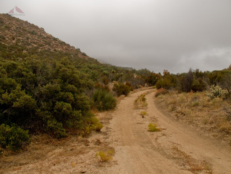
The view from the trailhead
10/04/2011
It's always nice to be able to get away. Even if sometimes the hike is the same duration as the drive to and from the trailhead. Sometimes it's the anticipation of the hike, of the view, of the experience.
After dropping my daughter off at preschool, I drove out to Anza-Borrego Desert State Park. It's a long drive and I had planned on bagging as many peaks as I could before I had to head back and pick up my daughter. I started to get a little worried when I drove through a lot of precipitation on the way to the trailhead.
Most of the time, as you drive east from San Diego proper, the weather tends to ease up and the clouds give way to sunny skies. This time, it didn't happen that way. And I learned when checking the weather that one adjacent zip code could vary widely from another.
After what seemed like hours, I arrived at the trailhead, which was just a little turnout where the dirt road turns towards Mount Tule. I quickly exited my car and put on some layers, including my waterproof jacket, as the sprinkles were already coming down.
As usual, the best way to warm up is to head down the trail. As I walked the slowly ascending trail, I figured I could have driven my car further up. But there were some sections that would challenge my car's abilities, so I felt good about parking where I did, at the crossroads.

Mount Tule in the Clouds
The smell of the wet sagebrush was overwhelmingly sweet. Being out in the San Diego backcountry after so long was almost intoxicating. It had been almost three months to the day since I had hiked a peak in San Diego, which was Long Valley Peak on July 9th.
I rounded a corner and saw Mount Tule with its head in the clouds before me.
The trail undulated over the terrain and I did not see any human prints in the sand. I saw some prints that could have been canine or feline, but they were too old to tell. The wind started coming in harder from the west, and I put my hood up as the rain started coming in from the side.
Once I got to the end of the old dirt road, I found a use trail leading steeply up the side of the mountain. From here, I got a peek into the desert floor below, which was sunny.

It's Sunny on the Desert Floor

Ascent into the Clouds
For most of the rest of the way, the way was pretty steep. The use trail was easy to lose as the wind and rain increased. It started to remind me of my first trip up to Bonny and White Benchmarks, but it wasn't quite as cold. I was pretty warm with the exertion, combined with my gloves and rain jacket. But it was pretty slow going, having to look for each cairn on the trail after reaching the last one.
I finally had a little break from the wind in a little depression on the west side of the northern summit. Then it was time to take the 2 minutes to scale the highest point.

Subtle Cairn - Go to the right of that post
A metal rod stuck out of the summit boulders and it made me a little nervous, given that I was in the clouds.
However, there had been no lightning yet that day, so I relaxed a little. I still didn't dally at the summit. I had been hoping for better views, but, as the wind blew, spaces in the clouds would appear, revealing the vast expanse of desert below me. I could also see some of the wooden trestles from the railroad going through Carrizo Gorge, a place I haven't been yet.

Metal Post on the Summit of Mount Tule - I was Worried about Lightning

View from the Summit of Mount Tule - Carrizo Gorge

Reference Mark on Mount Tule

Railroad Trestles over Carrizo Gorge from Mount Tule

View to the Northwest
I found a spot to the lee side of the summit boulders, where I could grab a snack and drink without being blown over by the wind.
Before the weather got any worse, I started down the way I had come. I could see some construction of the Sunrise Powerlink on my way down. I had seen this sort of development on my Bell Bluff hike, as well. These towers are huge, and I could see how these could severely impact the views of many homes in the area.

The trail below, leading back to the trailhead

Looking back up the mountain, use trail on the right of the short pole

Descending back to the car.

A last look back at Mount Tule, the middle hump

My Tiguan, the ultimate trailhead machine
It was a short hike, but at least it was interesting. And the smell of the damp sage and earth was worth the drive.
Mount Tule Trail Map (Click to Enlarge)
