


Long Valley Peak - Peak 65 - Hiking with the PD in a Fire Ant Swarm
Long Valley Peak
Elevation: 4,833′
Mileage: ~5
Trailhead: Bear Valley Trailhead
Agency: Cleveland National Forest
Date Hiked: 07/09/2011
Peakbagger.com Page
For those interested, here is a list of my gear that I have found works well for me. This is, of course, an affiliate link and your enjoyment of these may vary:
07/09/2011
I was initially planning on hiking Palomar Mountain on this day, but, at the 11th hour, literally, I decided on something with a little less distance and gain. Besides, it's a long drive to Palomar and I wanted to get in more hiking time.
I had seen Long Valley Peak from my hike to Corte Madera and Los Pinos Lookout and other hikes. It looked massive and challenging. It appeared to be capped with granite and surrounded by brush. Not the easiest place to get up.
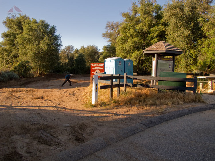
The PD and I are training for a backpacking trip to Colorado, so we wanted to get some distance in. We drove to the trailhead that is right next to the Interstate 8 freeway. I knew my car could probably drive to within half a mile to the summit of Long Valley Peak, but I wanted the hiking experience and training, so we parked there and got out.
Before long, the sounds of the freeway sank behind us as we started to climb on the dirt Pine Valley Road south of the 8.
One thing that I have noticed while hiking is that wherever cars can drive on the trail, the amount of trash and signs of human activity skyrockets. The road was littered with spent shotgun shells, auto parts, and broken glass. I have nothing against hunters or off-roaders, but a few of them sure are ruining it for others.

Some of the many shotgun shells we saw on Pine Valley Road
The morning was cool, a short respite from the baking heat we were sure to enjoy later in the hike and the view of Long Valley Peak from the road was great. Before long, we encountered the sharp bend in the road where there was a gate that lead to the start of our cross-country experience.
The PD stretching it out at the trailhead

Long Valley Peak

Long Valley Peak from Pine Valley Road

Cuyamaca Peak from Pine Valley Road

Gate where you leave the road
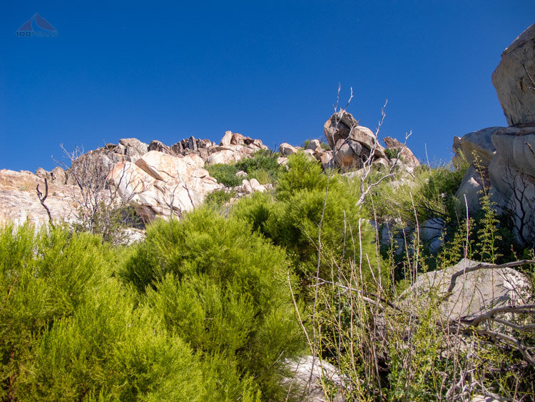
We found single-track trails that crisscrossed the area. We followed one to the north where it ultimately bent and started leading us to the southwestern flank of Long Valley Peak. We picked up a use or game trail that continued along the south and ultimately wrapped around most of the mountain. As we ascended, we moved from a regrowing burnt wasteland to the edge of the brush to a yellow grassland. Up and up, the faint trail finally lead us to a small wash that went to a saddle.
Looking back, we probably should have followed that trail as far as it could take us, because it wasn't long before we were shoulder-deep in brush, traveling north along the western shoulder of the southern sub-peak. It was here that we started to notice poison oak interweaving within the other brush we were whacking. I was wearing pants this time. You don't have to tell me twice.

Easy bushwhack portion through regrowing area after a fire

Following a use and game trail through the grass

The bushwhack getting more challenging with the summit of Long Valley Peak in sight
After scrambling and battling large brush, we finally made it to a large wash that leads to the shoulder between the southern sub-peak and the northern actual summit of Long Valley Peak. The going was steep but way easier than before and we vowed to return this way.
I had read other trip reports about this peak and had a picture of the summit where someone had drawn their path. I was confident we'd find the best way.
I left my trekking poles at the shoulder and we started steeply bouldering it through heavy brush. We angled over to the left, around a large boulder that rested on a large flat area.

The PD, deep into the bushwhack and avoiding poison oak

Still Smilin’
Looking up towards Long Valley Peak summit, swing around to the left of the large pale boulder
Above the large boulder, I swung back to the right and scrambled easily to the summit. The PD was not far behind.
Once atop the summit, we saw a flurry of activity. We first noticed some hummingbirds and butterflies fluttering about. We then saw some large black lizards aggressively eating what we thought were flies.
When we got closer, we noticed that the rust-colored rocks on the summit were covered with fire ants. Many had wings and others were coupling (or tripling). Soon we were covered with them, buzzing in our faces and crawling all over us. We quickly scooted to a rock on the edge of the summit where the breeze kept them at bay.

Too much red ant fun on my hat
We were presented with an unusually clear summer day, seeing farther to the south than is typical for a hot, humid July day. I could see scenic Corte Madera Valley to the southwest and and Cuyamaca Peak presiding over its domain to the north. We sat on the rock, enjoying the summit for longer than I normally do. Something I promised myself as my blog turned two years old.

Corte Madera Valley with Los Pinos behind

Guatay Mountain and Cuyamaca Peak from Long Valley Peak
We then started our way back down, with a short pause as I scrambled back up to sign the summit register.
We made pretty quick time as we descended the wash from where we came. We ended up descending too far, forcing us to lengthen our trip around the shoulder of the mountain and bushwhack far too much. We ultimately found the use trail that led us back to the road, but we felt there existed a middle ground and use trail that would have made this whole challenging trip much easier.

Looking down the wash on the west side of Long Valley Peak

Looking up the wash towards Long Valley Peak
Long Valley Peak Trail Map (Click to enlarge)
It was nice to have a hiking partner again. It had been 9 months since I had hiked with the PD and we had a blast together. Our trail experience grows each time we hike and we feel like our ability to "read the mountain" has evolved greatly when traveling off-trail.
We talked about future hikes, including Colorado's Chicago Basin in a few weeks, and other, more daring trips abroad. I am celebrating my 40th birthday next year, and any excuse I can get to do something crazy, I am up for it. And so is the PD.
