

Hot Springs Mountain - Peak #21 - San Diego's Highest Peak
Hot Springs Mountain
Elevation: 6,533′
Miles: ~10 miles
Trailhead: Los Coyotes Reservation Campground
Agency: Los Coyotes Band of Cahuilla & Cupeño Indians
Dates Hiked: 11/08/2009, 04/05/2014
Peakbagger.com Page
For those interested, here is a list of my gear that I have found works well for me. This is, of course, an affiliate link and your enjoyment of these may vary:
Update: Please review the information on the Los Coyotes site and check their Instagram account. They sometimes close the area for events. Their process is way easier and more user-friendly than it was in 2009. You can now purchase a permit online.
The road to the top of the mountain is now gated for visitors. The 10-mile hike is the only way to go. The top of the lookout tower has since collapsed in the mid-2010s.
11/08/2009
This weekend I had the privilege to have access to a peak that has been closed since Labor Day 2004: Hot Springs Mountain. From what I could ascertain, it was closed due to the behavior of some individuals who did not respect the tribal lands, including OHV drivers and campers.
It turns out that the highest peak would also be the easiest for me.
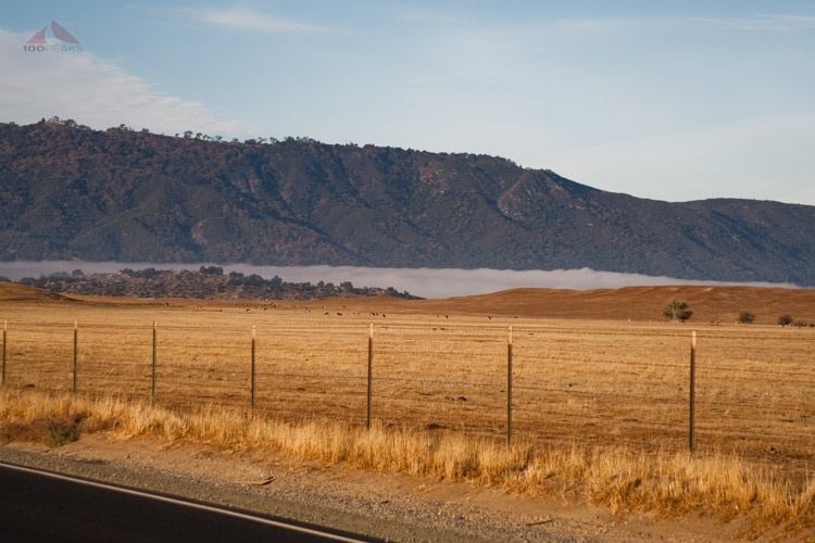
The Fog in Lake Henshaw Valley, on the way to Hot Springs Mountain
After driving through the foggy Lake Henshaw Valley and seeing Hot Springs Mountain from a distance, I arrived at the reservation a little early, as I was unsure of how long it would take to get there. I was to meet Robb at 8AM.
I had hiked Combs Peak with Robb and enjoyed my time with him.
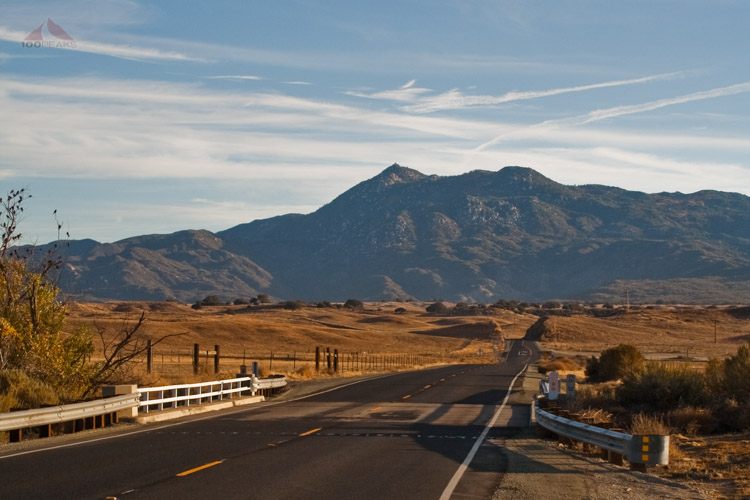
Hot Springs Mountain from the 79
There was no one at the gate at 7:30, so I drove into the reservation to find out where the road was that would either lead us to the peak, or lead us to the trailhead. Since the reservation has been closed for 5 years, information about trails and access is either outdated or sparse at best.
After basing my route on current online research at the time, I found the dirt road that would lead us up the mountain. I returned to the gate to find Robb there with his family. We waited a few minutes until a couple of Los Coyote tribal members drove up.
One man got out and opened the gate house, mentioning that he was just back from deer hunting with no luck. A couple of friendly dogs wandered by to say hello.
We asked the friendly man working at the gate why the reservation was closed for recreational use. He answered vaguely, "We were clearing some trees and doing tribal things." We chatted for a little bit.
I don't blame him for not really answering. He doesn't have to. We paid for and received maps.
It was a cool start for what was to be a pretty cool overall experience.
We drove down the road and took a left and drove up the dirt road up the mountain. I have an all-wheel-drive Tiguan, but kept my eyes on my rear-view-mirror, worried that my companions might get left behind on some of the steeper, gravel-covered hills.
We made it to a part of the road where it seemed that it started losing elevation, so we turned around to a clearing that looked like there was a trail leading off. Robb's GPS told us that Hot Springs Mountain was nearby, so we headed up the mountain.
When we got to the top, we could see the Hot Springs Mountain Fire Lookout Tower on a nearby peak, so we knew we were on the wrong mountain.
Looking at my Topo maps when I got home, I could see that Hot Springs Mountain is clearly written across the whole mountain, not on the peak, so it was easy to see how we were led astray. There were great views and it wasn't a long detour, so we took some breaths and pictures and headed back down and onto the road.

Hot Springs Mountain Fire Lookout Tower from Unnamed Peak

A view into the Los Coyotes Reservation
The road got sketchier, including a section with a large rock that had fallen off to one side, but the Tiguan handled it all great and we ended up getting all the way to the summit parking lot, which was only .2 miles from the summit and was placed directly in-between the Tower and the summit.
I would have preferred to do more hiking, but I wanted to scout out the way to the top of the road. I recommend a high-clearance car, and at least AWD if you have it, since some sections are a little sandy.
Before we went to the summit, we hiked to the Fire Lookout Tower.

The view to Palomar from Hot Springs Mountain in 2014

The Fire Lookout Tower on Hot Springs Mountain in 2009

Hot Springs Mountain Lookout Tower in 2014
We then went down to the summit lot and then did some minor bushwhacking and rock-climbing and ended up on the cement platform atop Hot Springs Mountain, the highest point in San Diego County.
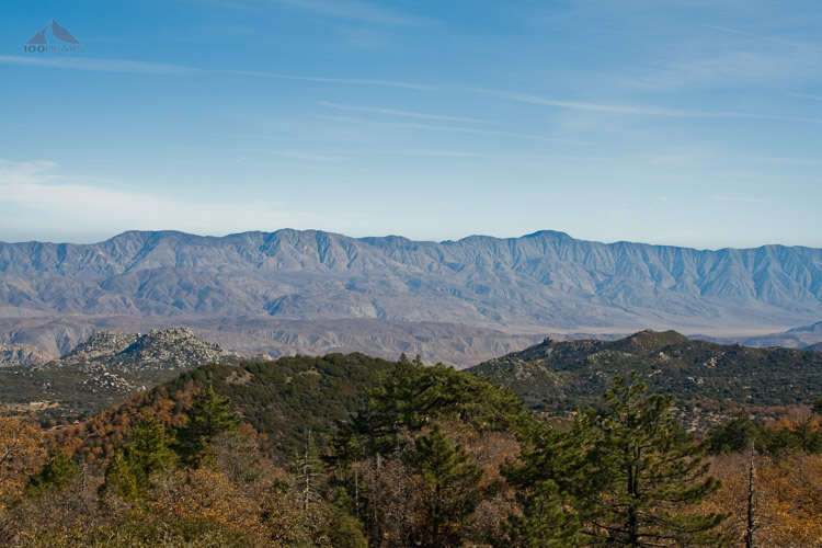
We could see deep into the Anza-Borrego Desert to the Santa Rosa Mountains. We could also see Combs Peak, which we summited last month. We signed the summit register and enjoyed the perfect weather and silence before we headed back down the way we came.

The tower from Hot Springs Mountain summit block in 2009

The Hot Springs Mountain Summit Register
The Santa Rosa Mountains from Hot Springs Mountain
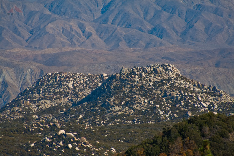
Square Top

Hot Springs Mountain San Diego Map (Click to Enlarge)
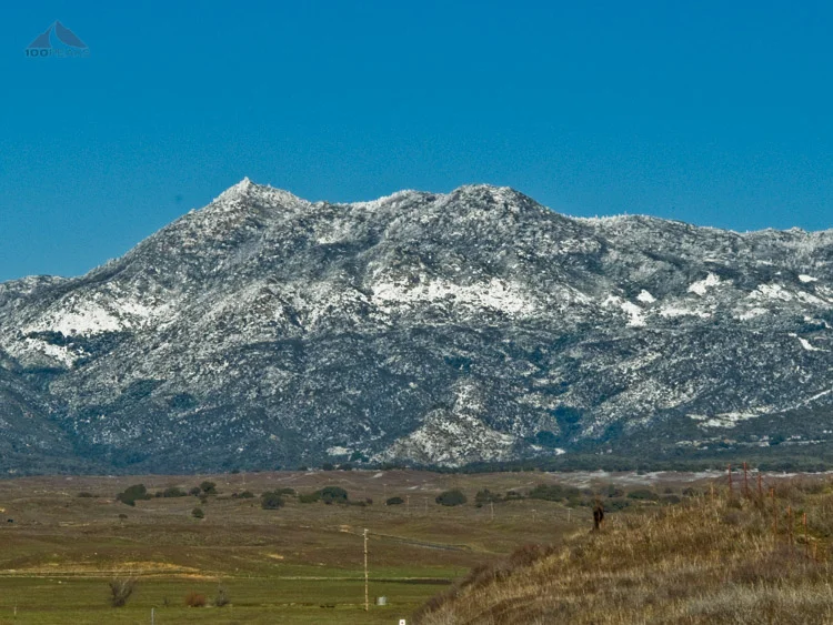
Update 02/27/2011: Shot this picture from Highway 79. A lot of snow had dumped on the area.

Hot Springs Mountain, San Diego, Covered in Snow in 2011

